

PIX4Dreact
PIX4Dreact
Regular price
€47,33 EUR
Regular price
Sale price
€47,33 EUR
Unit price
per
Tax not included.
Shipping calculated at checkout.
Couldn't load pickup availability


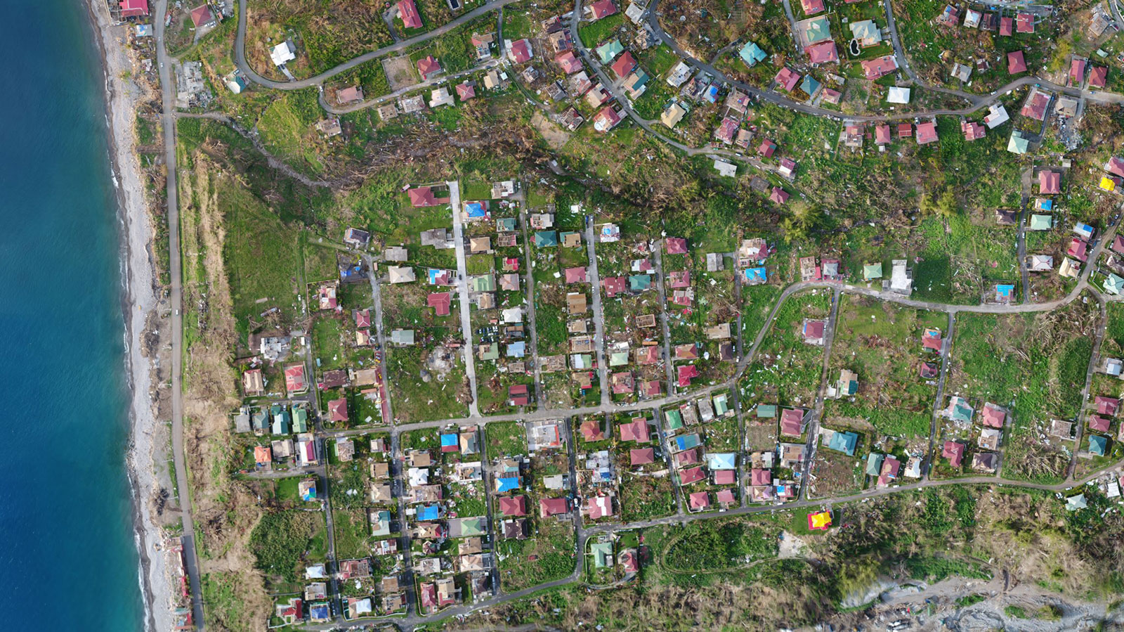
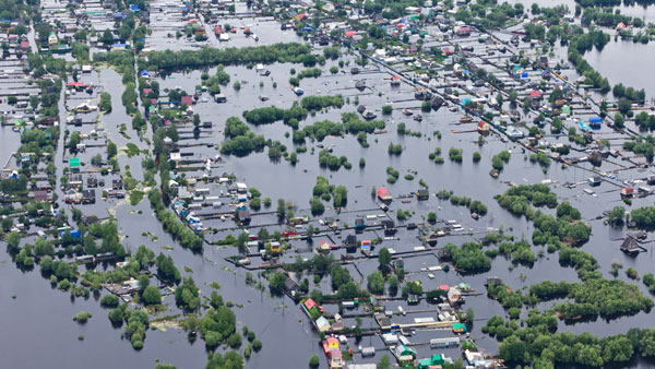
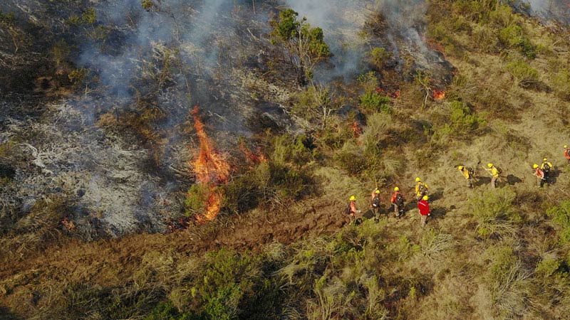
Rapid 2D mapping for emergency response and public safety
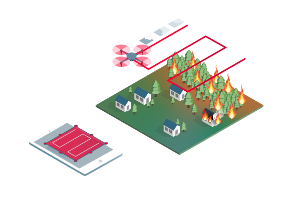
Capture
Fly your drone to capture the images you need. Plan an optimized and automated flight with an app like PIX4Dcapture for Parrot and DJI drones.

Process
Combine large numbers of images in minutes with PIX4Dreact. Create 2D maps measurable in the field or at base.
*Results and speed vary depending on size and number of images.
*Results and speed vary depending on size and number of images.

To examine
With PIX4Dreact's simple tools, you can identify and measure points of interest, mark up and evaluate maps while in the field to provide the data you need to take action.

Share
Export your maps to ensure teams and decision makers receive effective information when it is needed most.
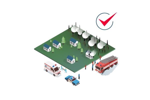
Answer
With updated maps, you gain valuable time, improve safety and reduce costs when responding to an evolving situation.
The mapping software for emergency response
Get fast, reliable situational awareness to make quick decisions and collaborate in the field.
Fast
PIX4Dreact creates 2D maps from aerial images in minutes. Because when every second counts, up-to-date and reliable information is of utmost importance for teams on the ground.
Easy to use
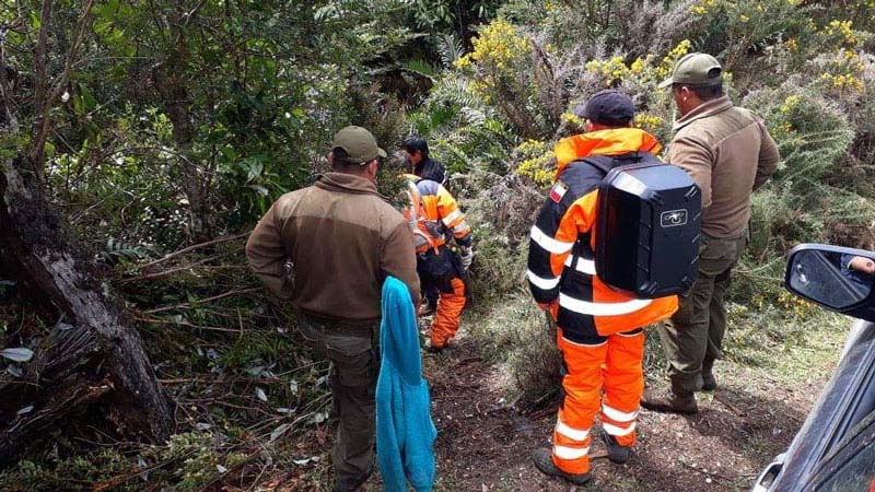
Simple and intuitive to use, even in complex and stressful situations. PIX4Dreact was developed with public safety and humanitarian aid professionals to address their unique challenges.
Lightweight and robust
Light enough to use on a mid-range computer in the field. PIX4Dreact does not rely on an internet connection or the cloud for processing.

Share the results
PIX4Dreact results can be uploaded to PIX4Dcloud for sharing. Export your maps and reports and seamlessly send them to colleagues or teams in the field.
In a crisis, every second counts.
Reliable situational awareness in complex situations

FAST AND INTUITIVE MAPPING

MEASURE AND MARK THE AREAS OF INTEREST

COMPARE THE MAPS

EASY AND FAST EXPORT

SHARE WITH PIX4DCLOUD

FIT FOR PURPOSE
The map you need when you need it
Ensure teams and decision makers receive timely and effective information to take action.
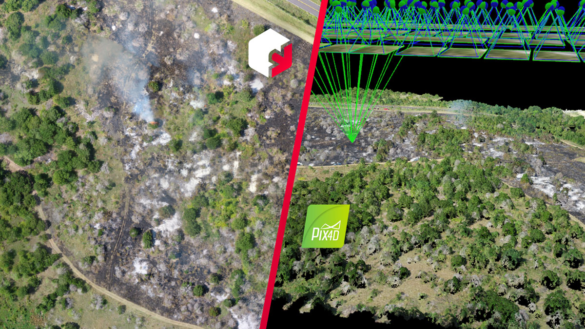
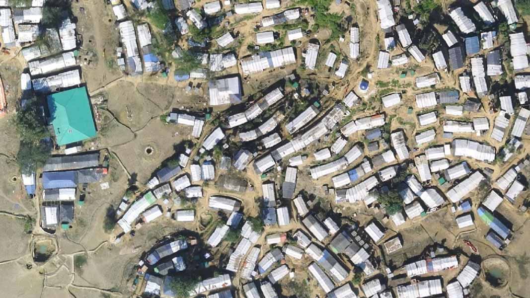
2D orthomosaic map
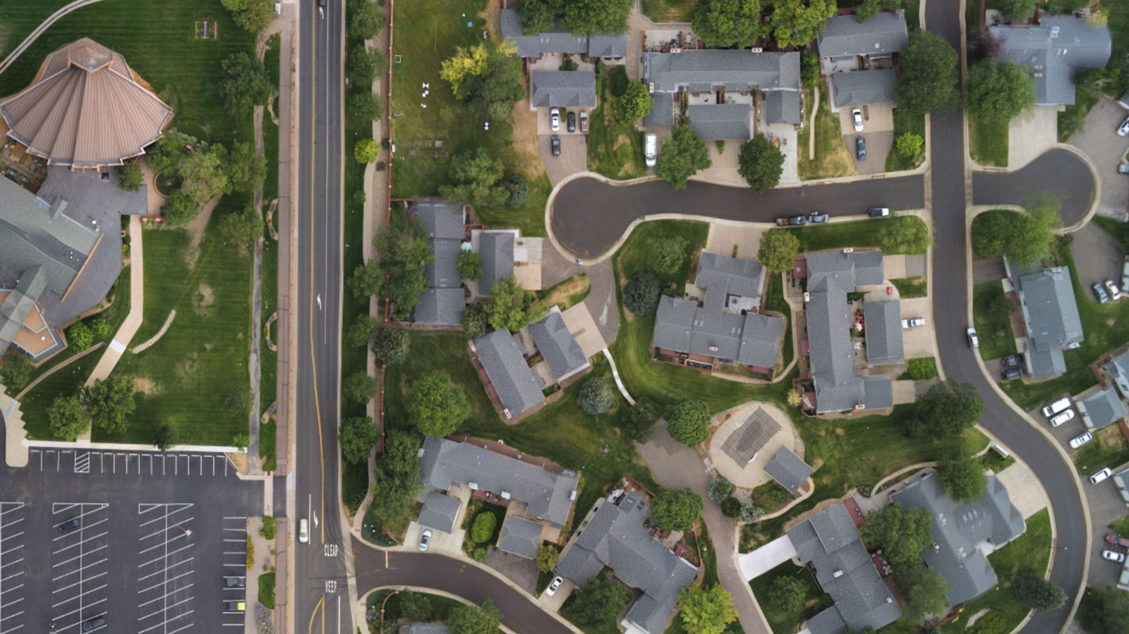
PIX4Dreact uses fast-stitching technology to create accurate 2D orthomosaic maps by combining a large number of drone nadir images.
Export format: geoTIFF
Markers and measurements
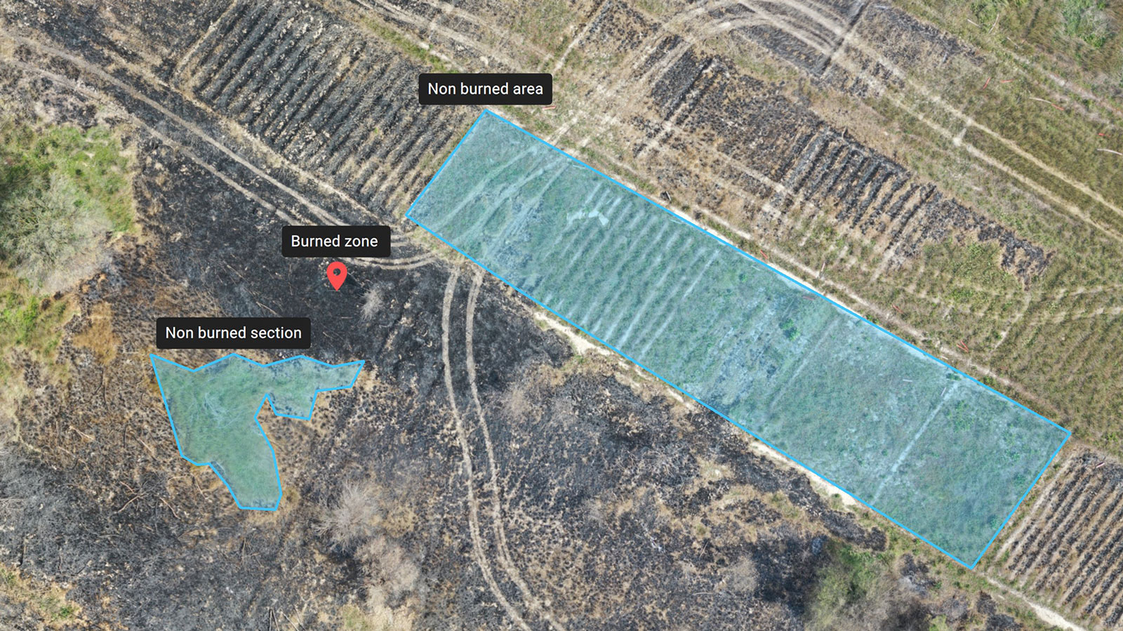
Report areas of interest or GPS coordinates within the project and assess the situation on the ground for easier collaboration or long-term documentation.
Marker export formats: GeoJSON, KML, Shapefile
Measurement export format: PDF
Measurement export format: PDF
Full screenshots and maps
Document and collaborate in seconds with the ability to export your maps as screenshots or an entire map that can be imported into PIX4Dreact on another computer.
Screenshot export format: JPEG
Full map export format: p4r
Full map export format: p4r
PDF report
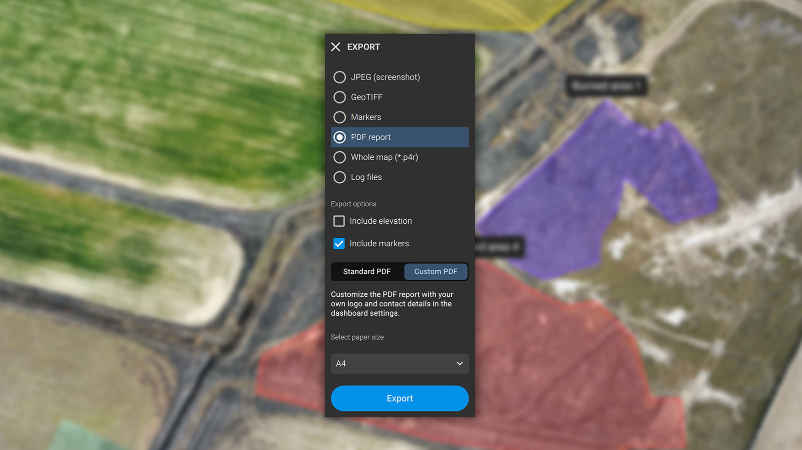
Easily share a 2D orthomosaic, location data and markers in a single file via email. Personalize the report with a white label with your company data and logo.
Export format: PDF
Help emergency teams in the field
Developed with the help of emergency responders, PIX4Dreact was designed to be the optimal 2D rapid mapping software for public safety and humanitarian aid professionals.


Shipping and Warranty
Shipping and Warranty
All products available in stock will be delivered with an average timing of 24/48 hours.
Italy warranty with dedicated consulting support, contact us!

Contacts
3Digital by De Zan Davide
Operational Headquarters and Sales Point :
Via Cervano 67/A
31020 San Pietro di Feletto, Treviso
Italy
Registered office :
Via Maset 31/B
31020 San Pietro di Feletto, Treviso
Italy
VAT number IT 05295090269
We are operational from Monday to Friday, from 8.30am to 12.30pm and from 3pm to 5pm.
Commercial consultancy +39 0438 1693056 ( Elettra , our virtual assistant based on artificial intelligence, will answer you. Leave your request and you will be contacted by an operator shortly. If you urgently need to speak to someone immediately, just say "I want to speak to an operator ")
Technical assistance and repairs visit this page
Email: contact@3digital.tech
Pec: legal@pec.3digital.tech (receives only from certified addresses)
-
Free shipping, return in 14 days *.
DisclosureFree express shipping for orders over € 499.
* For return terms and conditions, please visit our returns and refunds policy.
-
-
Are you a professional or a company?
Contact usYou can ask us for an invoice for your purchases! All the prices of our products already include VAT.
-
Do you have the teacher's card?
Contact usProceed with checkout and select "Teacher's Card" as the payment method. Requests?