DJI Terra Educational (Permanent - 10 devices)
DJI Terra Educational (Permanent - 10 devices)
Couldn't load pickup availability


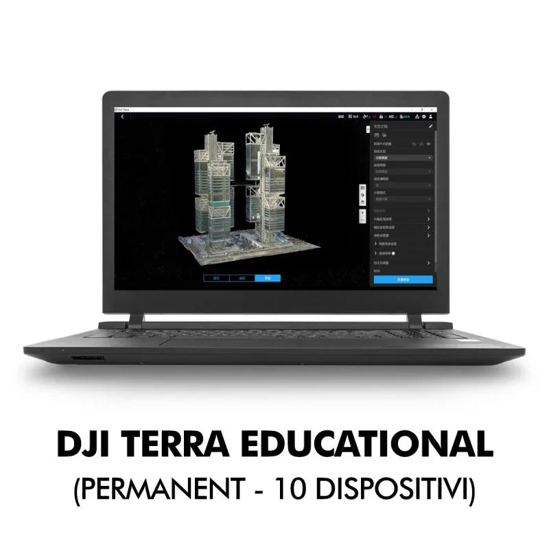
DJI Terra is 3D modeling software featuring next-generation reconstruction technologies, including 3D Gaussian Splatting (not included in the Standard version). It supports accurate and efficient 2D and 3D reconstruction from visible light images and processes data collected by DJI LiDARs. Integrated with DJI drones and DJI Modify (optional), Terra offers a unified hardware and software solution for data acquisition, processing, and analysis, optimizing aerial survey workflows for greater efficiency and precision.
DJI Terra is 3D modeling software featuring next-generation reconstruction technologies, including 3D Gaussian Splatting (not included in the Standard version). It supports accurate and efficient 2D and 3D reconstruction from visible light images and processes data collected by DJI LiDARs. Integrated with DJI drones and DJI Modify (optional), Terra offers a unified hardware and software solution for data acquisition, processing, and analysis, optimizing aerial survey workflows for greater efficiency and precision.
- Gaussian Splatting (not included in the Standard version): Terra introduces Gaussian Splatting, which quickly generates detailed and realistic 3D models from photos, accurately reconstructing various scenes such as cultural relics, architectural projects, urban blocks, and scenic gardens.
- Photogrammetry: Terra quickly generates high-precision 3D models, point clouds, digital true orthophoto maps (TDOM), and digital surface models (DSM) from photos.
- LiDAR Reconstruction: Terra enables deep integration of LiDAR and visible light data. With a single acquisition by Zenmuse LiDARs, users can simultaneously generate high-precision point clouds, 2D maps, and 3D mesh models.
- Multispectral Reconstruction: Leverage multispectral data acquired by DJI Mavic 3 Multispectral and Phantom 4 Multispectral to create NDVI and NDRE index maps and gain insights into plant growth and health. Terra also supports radiometric correction and reflectance map creation for remote sensing analysis.
- Hardware Synergy for Multi-scene Aerial Surveying: When used with Matrice 4E, Matrice 400, Zenmuse P1, Zenmuse L2, and D-RTK 3, Terra offers cost-effective visible light mapping and professional-grade LiDAR solutions.
- Authorization Modes: Online authorization and offline authorization are supported.
System requirements: Windows 10 or higher (64-bit), 32 GB RAM, and an NVIDIA graphics card with at least 4 GB GPU memory and compute capability 6.1 or higher.
.jpg)
Shipping and Warranty
Shipping and Warranty
All products available in stock will be delivered with an average timing of 24/48 hours.
Italy warranty with dedicated consulting support, contact us!