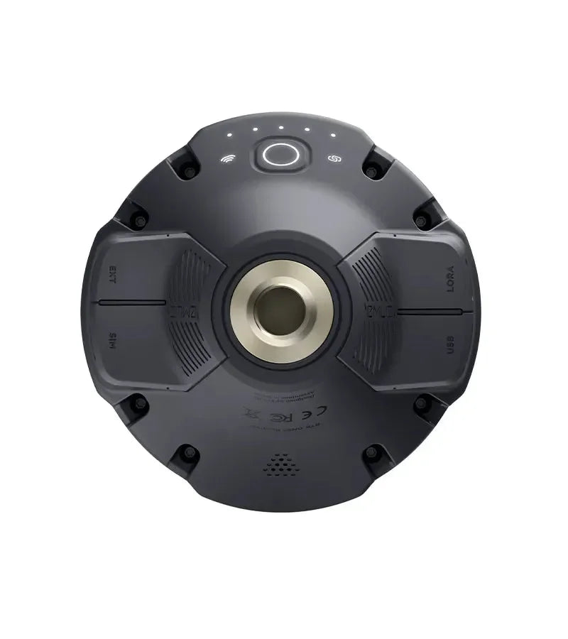
EMLID REACH RS3
EMLID REACH RS3
Impossible de charger la disponibilité du service de retrait


Récepteur GNSS RTK multifréquence L1-L2-L5 et multicontellation avec compensation d’inclinaison (TILT) basée sur l’IMU. Il n'est pas nécessaire de contrôler la nivelle de mesure. Avec Reach RS3, il est possible d'effectuer des relevés même dans des zones peu accessibles avec une inclinaison allant jusqu'à 60 degrés, tout en maintenant une précision de 20 mm.
Disponible dans la double configuration : Rover uniquement (NTRIP) ou Base-Rover (LoRa).
Reach RS3 est le nouveau GNSS RTK de la marque Emlid, capable d'atteindre des précisions jamais vues auparavant. Il utilise la compensation d’inclinaison (TILT) basée sur l’IMU, ce qui permet d'effectuer des mesures avec une inclinaison allant jusqu'à 60° tout en maintenant une précision de 2 cm. Reach RS3 mesure et corrige continuellement l'inclinaison en temps réel. Il n'est en effet plus nécessaire de contrôler la nivelle de mesure grâce à la compensation TILT, qui permet à ce GPS topographique de réaliser des relevés même dans des zones peu accessibles.
Compensation de l'inclinaison TILT
Toutes les antennes GNSS RS3 sont étalonnées individuellement en usine. Cela signifie que vous pouvez être opérationnel immédiatement après l'achat. La robuste compensation de l'inclinaison (TILT) rend l'Emlid Reach RS3 insensible aux perturbations magnétiques, même si vous travaillez à proximité de structures métalliques.
FIX en 5 secondes
Avec Reach RS3, vous obtenez le FIX en environ 5 secondes et maintenez des performances précises même lorsque le ciel est partiellement obstrué ou que le récepteur est incliné. Il utilise une combinaison de signaux GPS/QZSS, GLONASS, BeiDou, Galileo pour fournir une couverture mondiale et une convergence RTK rapide.
Modem LTE et enregistrement des données
Avec Reach RS3, vous avez l'embarras du choix sur la façon de relever vos points. Il est possible de travailler en RTK avec VRS ou avec un réseau CORS (stations permanentes) à bande unique. Il suffit d'insérer la carte SIM de l'opérateur de votre choix pour transmettre et recevoir les corrections via NTRIP. Il est également possible de connecter un autre récepteur GNSS comme base NTRIP en utilisant l'Emlid NTRIP Caster. Lorsqu'il est nécessaire d'effectuer un relevé dans des zones sans couverture Internet pour NTRIP, vous pouvez connecter deux récepteurs (un Rover et une Base) qui communiquent entre eux par radio (LoRa). UHF 450 MHz Rover représente une option pour combiner les récepteurs RTK. Vous pouvez configurer Reach RS3 pour recevoir les corrections d'une base existante ou utiliser une radio externe haute puissance sur la base Reach et la connecter au récepteur radio UHF du Reach RS3.
Pour l'enregistrement des données brutes, vous pouvez utiliser le logiciel gratuit PPK Emlid Studio ou tout autre logiciel prenant en charge le format RINEX. Les journaux RINEX sont également compatibles avec les services OPUS, AUSPOS et PPP afin que vous puissiez obtenir des résultats précis partout dans le monde.
Plus d'heures de travail avec une seule charge
La batterie intégrée haute performance du Reach RS3 peut supporter jusqu'à 22 heures d'enregistrement ou 18 heures de travail avec TILT en RTK. Elle gère bien les hautes et basses températures et peut effectuer plus de 2000 cycles de charge et de décharge.
TPad : le logiciel topographique de terrain
Le logiciel topographique de terrain TPad est utilisable sur tous les appareils Android et permet de relever et d'implanter des points en temps réel. Il est doté de nombreuses fonctions gérées dans un véritable CAD Topographique : lignes, arcs, cercles, textes, photos, vidéos, calques.
Avec TPad, vous pouvez superposer des cartes cadastrales ou satellites à votre relevé, mesurer et implanter des points, calculer de nouveaux points avec les fonctions CoGo, mesurer des points cachés ou des angles de bâtiments avec la fonction « point par intersection », exporter et visualiser votre relevé sur Google Earth, et bien plus encore.
Fiche technique Emlid Reach RS3
| Caractéristiques | Spécifications |
| TILT | Compensation d'inclinaison jusqu'à 60° basée sur l'IMU avec une précision de 2 cm. |
| Suivi des signaux | GPS/QZSS L1C/A, L2C GLONASS L1OF, L2OF BeiDou B1I, B2I Galileo E1-B/C, E5b |
| Convergence RTK | Rapide |
| Antenne LoRa | 868/915 MHz, connectivité jusqu'à 8 km |
| Modem LTE | Global, bandes FDD-LTE globales : 1,2,3,4,5,7,8, 12, 13, 18, 19, 20,26, 28, 66 TD-LTE: 38,40,41; UMTS (WCDMA/FDD): 1,3,2,4,5,6, 8,19 quadribande, 850/1900,900/1800 MHz, carte nano SIM |
| Autonomie | 18 heures avec une seule charge avec TILT en RTK |
| Corrections de données | NTRIP, LoRa et UHF 450 MHz Rover |
| Enregistrement des données | RINEX à un taux de mise à jour jusqu'à 10 Hz, 16 Go de mémoire interne |
| Connectivité | LoRa UHF, 3.5G, Wi-Fi 802.11 b/g/n, Bluetooth 4.0/2.1 EDR, ports RS-232, USB Type-C |
| Corrections | NTRIP, RTCM3 |
| Batterie | Lithium-ion, 5200 mAh, 7.2 V 37.44 Wh |
| Protection | IP67, imperméable et résistant à la poussière |
| Chargement | USB-C 5 V 3 A |
| Ports | RS-232, USB Type-C |
| Application | TPad pour Android |
Service de correction NRTK inclus (Optionnel)
Avec l'option TruePoint CM (1 AN), vous obtenez la précision centimétrique maximale garantie sur toutes les constellations (Full GNSS). Un service de correction NRTK illimité pendant 12 mois, idéal pour travailler immédiatement sans interruption et avec une fiabilité maximale.
Expédition et Garantie
Expédition et Garantie
Tous les produits disponibles en stock seront livrés dans un délai moyen de 24/48 heures.
Garantie Italie avec support de conseil dédié, contactez-nous !