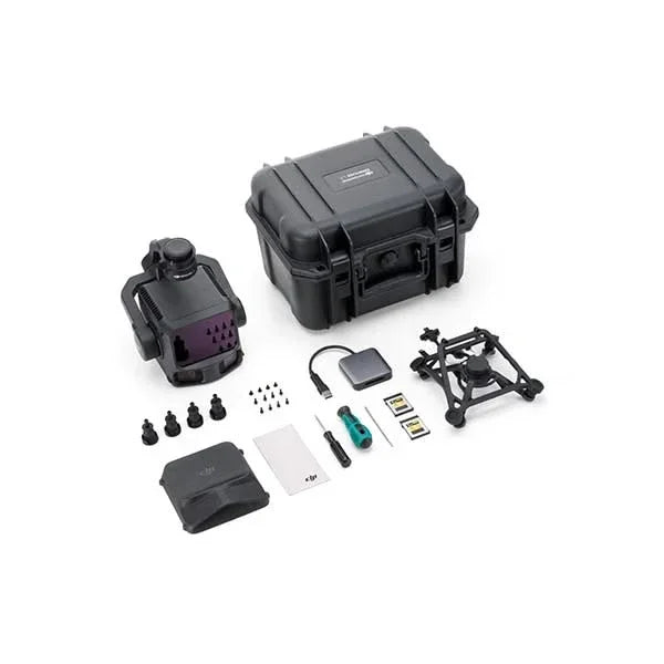
DJI Zenmuse L3 SP Plus
DJI Zenmuse L3 SP Plus
Prix habituel
€15.000,03 EUR
Prix habituel
Prix promotionnel
€15.000,03 EUR
Taxes incluses.
Frais d'expédition calculés à l'étape de paiement.
Quantité
Impossible de charger la disponibilité du service de retrait


Système LiDAR longue portée de 1535 nm avec double caméra RGB de 100 MP. Haute précision, pénétration élevée et couverture jusqu'à 100 km² par jour.
Solution complète avec DJI Care Enterprise Plus 1 an incluse.
⚠️ Compatible avec DJI Matrice 400 (Non compatible avec M300/M350 RTK)
Le Zenmuse L3 est le premier système LiDAR aérien longue portée et haute précision de DJI, conçu pour les opérateurs SIG, les levés topographiques à grande échelle, les infrastructures critiques et les missions géospatiales professionnelles.
Caractéristiques clés
- Le système intègre un module LiDAR à longueur d’onde de 1535 nm permettant une portée allant jusqu'à 950 m même sur des surfaces avec une réflectivité de 10 %.
- Paire de caméras RGB de 100 MP chacune (capteur 4/3″) avec obturateur mécanique, idéales pour la cartographie haute résolution et en couleur réelle.
- Précision élevée : par exemple, à une altitude de vol de 120 m, la précision verticale RMSE est d'environ 3 cm, et l'horizontale d'environ 4 cm.
- Couverture quotidienne allant jusqu'à 100 km², permettant des relevés efficaces et à grande échelle.
- Support multi-échos jusqu'à 16 retours, améliorant la pénétration de la végétation et la densité du point au sol.
- Système POS (Positioning and Orientation System) haute précision et stabilisation sur 3 axes (nacelle) intégrés pour une installation compacte et opérationnelle.
- Compatibilité : conçu pour un montage rapide via la fixation SkyPort sur le drone DJI Matrice 400 (note : non compatible avec M300/M350 RTK).
Avantages opérationnels
- Efficacité maximale : grâce à sa portée étendue et à sa vitesse d’acquisition de données élevée, il permet de couvrir de grandes surfaces en moins de temps que les systèmes conventionnels.
- Haute résolution et qualité couleur : les caméras de 100 MP fournissent des images RGB détaillées, parfaites pour améliorer la classification et l’interprétation des nuages de points.
- Précision topographique : la combinaison LiDAR + POS garantit des données répondant aux exigences élevées des relevés topographiques, infrastructurels et environnementaux.
- Pénétration et polyvalence : le module LiDAR 1535 nm améliore la pénétration sous la végétation et dans des conditions difficiles, le rendant adapté également aux inspections de lignes électriques et aux relevés d'ingénierie.
- Workflow intégré : il fait partie de l’écosystème DJI Enterprise (planification de mission, acquisition, traitement), facilitant l’intégration dans les flux de travail professionnels.
Indications à l'utilisateur
- Montage exclusif sur DJI Matrice 400 : s'assurer de la compatibilité et de la configuration de l'appareil.
- Pour obtenir une précision et des performances maximales, planifier des altitudes appropriées (par ex. 120-300 m) et des conditions optimales de lumière et de réflectivité.
- Utiliser des logiciels compatibles (ex. DJI Terra) pour le traitement des nuages de points et les workflows SIG/archéologiques.
- Prendre en considération les conditions environnementales : le matériel est conçu pour fonctionner dans une large plage thermique et environnementale.
Expédition et Garantie
Expédition et Garantie
Tous les produits disponibles en stock seront livrés dans un délai moyen de 24/48 heures.
Garantie Italie avec support de conseil dédié, contactez-nous !