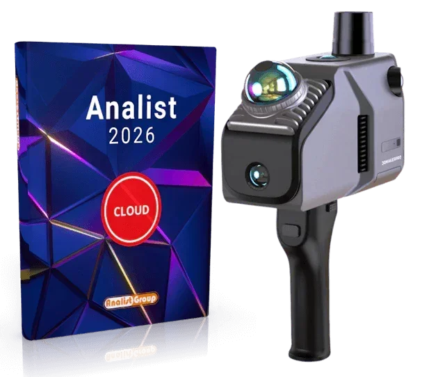
3DMakerpro Eagle Scanner LIDAR
3DMakerpro Eagle Scanner LIDAR
Impossible de charger la disponibilité du service de retrait


Caractéristiques et propriétés
- LiDAR haute performance
- 4 caméras de 48 MP (version MAX)
- Champ de vision 360° x 59°
- Splatting gaussien 3D
3DMakerpro Eagle est une véritable puissance parmi les scanners 3D ! Que vous souhaitiez capturer numériquement de vastes paysages architecturaux, créer des scènes suggestives pour des productions cinématographiques ou monter des expositions virtuelles, Eagle est votre copilote fiable qui vous mènera à destination en un temps record. Équipé d'un LiDAR haut de gamme, de brillantes caméras de 48 MP et d'un logiciel intelligent, il transforme en un instant les environnements en scènes 3D réalistes. Il suffit de le déballer, de l'allumer et de commencer !
LiDAR haute performance : portée accrue, précision supérieure
Grâce à son système LiDAR puissant, Eagle bénéficie d'une vision complète à 360 degrés. Il effectue des scans à une distance maximale de 70 mètres (avec 80 % de réflectivité !) et fournit des détails d'une netteté exceptionnelle, avec une précision allant jusqu'à 2 cm à une distance de 10 mètres. De cette façon, il est possible de créer facilement non seulement des modèles à grande échelle, mais aussi des quartiers entiers en un temps record.
Champ de vision énorme : tout à portée de vue !
Grâce à son champ de vision de 360°×59°, Eagle ne perd rien ! Par rapport aux autres scanners sur le marché, il offre une couverture supérieure de 30 %. D'un seul mouvement, vous pouvez scanner sans effort des pièces entières ou des paysages.
Jusqu'à 4 caméras pour des détails brillants
Grâce à un maximum de quatre caméras haute résolution de 48 MP (selon le modèle → 1 caméra pour le Standard, 4 caméras pour le Max), il enrichit votre projet avec des couleurs éclatantes et des textures ultra-raffinées. Le scanner fournit des images HDR 8K qui donnent vie à vos mondes 3D sans effort.
Splatting gaussien 3D : de la photo à la scène 3D réaliste
Eagle transforme vos images en scènes 3D réalistes via le Gaussian Splatting. Les données sont directement compatibles avec Unreal Engine et fournissent des modèles 3D de haute qualité pour les jeux, les visites virtuelles ou les décors de cinéma.
Visites virtuelles et immersives
Créez des visites panoramiques à couper le souffle qui vous donneront l'impression de faire une véritable promenade : grâce aux images HDR 8K, vous pouvez profiter du jeu de lumière, des ombres et des textures dans une qualité optimale !
Déballez et commencez : solution tout-en-un
Oubliez les calibrages compliqués ! 3DMakerpro Eagle est immédiatement prêt à l'emploi et vous fait économiser jusqu'à 50 % de temps de préparation. Il suffit de le déballer, de l'allumer et de commencer le scan immédiatement. La visualisation des données en temps réel sur l'écran intégré de 3,5 pouces affiche ce qui se passe dans l'aperçu en direct.
Flexible et rapide en déplacement
À pied, monté sur un véhicule ou sur différentes plateformes, Eagle est un véritable polyvalent ! Avec un maximum de 200 000 points enregistrés par seconde, la qualité des données reste stable même à une vitesse de 20 km/h.
Logiciel intelligent inclus
Naturellement, Eagle est également à la hauteur pour la post-traitement. Grâce au logiciel intuitif, vous pouvez affiner vos nuages de points, les exporter dans des formats tels que PLY, PNG, OBJ ou Gaussian-Splatting PLY et partager votre travail avec la communauté.
Le logiciel de modélisation autonome vous assiste dans la modélisation et le relevé de nuages de points, de manière directe et simple.
La livraison inclut :
- 1 scanner 3D Eagle LiDAR
- 1 poignée
- 1 adaptateur secteur PD
- 1 câble Type-C à double extrémité de 1,5 m
- 1 carte TF de 128 Go
- 1 adaptateur USB-C vers USB-A
► Eagle avec module RTK. Qu'est-ce que cela signifie ?
RTK signifie Real Time Kinematic (cinématique en temps réel), une technologie de mesure dynamique qui utilise des mesures de phase porteuse pour permettre le GPS différentiel en temps réel (RTDGPS). Habituellement, des signaux à double fréquence provenant de systèmes satellitaires tels que GPS, GLONASS, Galileo et Compass sont utilisés.
Le résultat ? Vos nuages de points atteignent une précision impressionnante allant jusqu'à 1–3 cm ! La condition préalable est une station de base qui communique sans fil avec le module RTK via les fréquences L1 (1575,42 MHz) et L2 (1227,60 MHz). On obtient ainsi des résultats précis même lorsque les choses deviennent un peu plus dynamiques.
Spécifications techniques :
| Eagle Standard | Eagle Max | |
| Dimensions | 115 x 181 x 106 mm | |
| Poids | 1500 g | |
| Précision | 2 cm à 10 m de distance 3 cm à 20 m de distance 5 cm à 40 m de distance |
|
| Portée de scan | 80–140 mètres | |
| Angle de scan | 360° horizontal 59° vertical |
|
| Fréquence du nuage de points | 200 000/sec. | |
| Source de lumière laser | 905 nm | |
| Classe laser | Classe 1, IEC60825-1:2014 | |
| Mode HDR | supporte 3–5 EV | |
| Texture couleur | 1 caméra fisheye de 48 MP | 4 caméras fisheye de 48 MP |
| Qualité de l'image | 8K Panoramic Color Output | |
| 2 ports USB de type C | 80–140 mètres | |
| Connexion | Wi-Fi5 | |
| Écran | 3,5 pouces | |
| Formats de sortie | 3D Color Point Cloud (PLY); 3D Gaussian Splatting (PLY); 3D Colored Polygonal Model (OBJ); 3D Panoramic Tour Data (OBJ) | |
| Batterie | 12 000 mAh, intégrée | |
Service de correction NRTK inclus (optionnel)
Avec l'option TruePoint CM (1 AN) vous obtenez la précision centimétrique maximale garantie sur toutes les constellations (Full GNSS). Un service de correction NRTK illimité pendant 12 mois, idéal pour travailler immédiatement sans interruption et avec une fiabilité maximale.
Expédition et Garantie
Expédition et Garantie
Tous les produits disponibles en stock seront livrés dans un délai moyen de 24/48 heures.
Garantie Italie avec support de conseil dédié, contactez-nous !