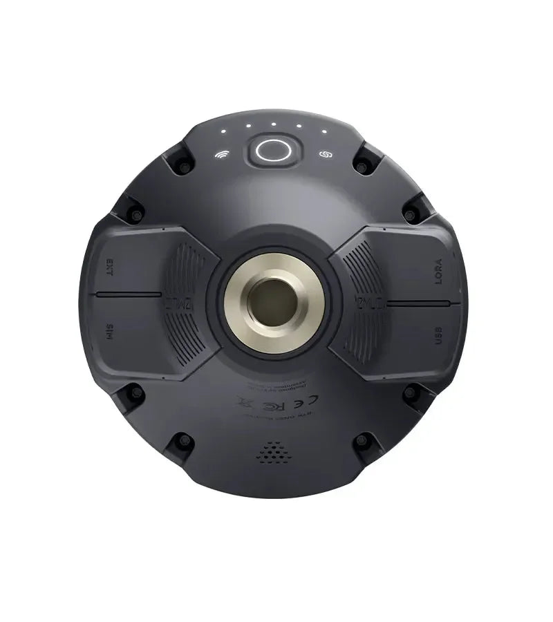
EMLID REACH RS3
EMLID REACH RS3
Couldn't load pickup availability


Multifrequency L1-L2-L5 and multi-constellation GNSS RTK receiver with IMU-based tilt compensation. No need to check the leveling bubble. With Reach RS3, surveys can be carried out even in hard-to-reach areas with an inclination of up to 60 degrees, maintaining an accuracy of 20 mm.
Available in two configurations: Rover only (NTRIP) or Base-Rover (LoRa).
Reach RS3 is Emlid's new GNSS RTK that can achieve unprecedented accuracy. It uses IMU-based tilt compensation, which allows measurements to be taken with an inclination of up to 60° while maintaining 2cm accuracy. Reach RS3 continuously measures and corrects tilt in real-time. It is no longer necessary to check the leveling bubble thanks to tilt compensation, which makes this topographic GPS capable of surveying even in hard-to-reach areas.
Tilt Compensation
All RS3 GNSS antennas are individually calibrated at the factory. This means you can start working immediately after purchase. The robust tilt compensation makes Emlid Reach RS3 immune to magnetic disturbances, even when working near metal structures.
FIX in 5 seconds
With Reach RS3, you get a FIX in about 5 seconds and it maintains accurate performance even when the sky is partially obstructed or the receiver is tilted. It uses a combination of GPS/QZSS, GLONASS, BeiDou, Galileo signals to provide global coverage and fast RTK convergence.
LTE Modem and Data Logging
With Reach RS3, you have a wide choice of how to survey your points. You can work in RTK with VRS or with a single-band CORS network (permanent stations). Simply insert the SIM card of your preferred operator to transmit and receive corrections via NTRIP. You can also connect another GNSS receiver as an NTRIP base using Emlid NTRIP Caster. When you need to survey in areas without Internet coverage for NTRIP, you can connect two receivers (one Rover and one Base) that communicate with each other via radio (LoRa). UHF 450 MHz Rover is an option for combining RTK receivers. You can configure Reach RS3 to receive corrections from an existing base or use a high-power external radio on the Reach base and connect it to the Reach RS3 UHF radio receiver.
For raw data logging, you can use the free PPK Emlid Studio software or any other software that supports the RINEX format. RINEX logs are also compatible with OPUS, AUSPOS, and PPP services so you can get accurate results anywhere in the world.
More hours of work on a single charge
The integrated high-performance battery of Reach RS3 can support up to 22 hours of logging or 18 hours of work with TILT in RTK. It can handle high and low temperatures well and can perform over 2000 charge and discharge cycles.
TPad: the field surveying software
The TPad field surveying software can be used on all Android devices and allows real-time point surveying and staking. It features numerous functions, all managed within a true Topographic CAD: lines, arcs, circles, texts, photos, videos, layers.
With TPad, you can overlay cadastral or satellite maps onto your survey, measure and stake out points, calculate new points with CoGo functions, measure hidden points or building corners with the "point by intersection" function, you can export and view your survey on Google Earth and much more.
Emlid Reach RS3 Technical Specifications
| Features | Specifications |
| TILT | IMU-based tilt compensation up to 60° with 2cm accuracy. |
| Signal Tracking | GPS/QZSS L1C/A, L2C GLONASS L1OF, L2OF BeiDou B1I, B2I Galileo E1-B/C, E5b |
| RTK Convergence | Fast |
| LoRa Antenna | 868/915 MHz, connectivity up to 8 km |
| LTE Modem | Global, FDD-LTE global bands: 1,2,3,4,5,7,8, 12, 13, 18, 19, 20,26, 28, 66 TD-LTE: 38,40,41; UMTS (WCDMA/FDD): 1,3,2,4,5,6, 8,19 quad-band, 850/1900,900/1800 MHz, nano SIM card |
| Battery Life | 18 hours on a single charge with TILT in RTK |
| Data Corrections | NTRIP, LoRa and UHF 450 MHz Rover |
| Data Logging | RINEX at an update rate of up to 10 Hz, 16 GB internal memory |
| Connectivity | LoRa UHF, 3.5G, Wi-Fi 802.11 b/g/n, Bluetooth 4.0/2.1 EDR, RS-232, USB Type-C Ports |
| Corrections | NTRIP, RTCM3 |
| Battery | Lithium-ion, 5200 mAh, 7.2 C 37.44 Wh |
| Protection | IP67, waterproof and dustproof |
| Charging | USB-C 5 V 3 A |
| Ports | RS-232, USB Type-C |
| App | TPad for Android |
NRTK Correction Service Included (Optional)
With the TruePoint CM (1 YEAR) option, you get maximum centimeter accuracy guaranteed across all constellations (Full GNSS). An unlimited NRTK correction service for 12 months, ideal for immediate and uninterrupted work with maximum reliability.
Shipping and Warranty
Shipping and Warranty
All products available in stock will be delivered with an average timing of 24/48 hours.
Italy warranty with dedicated consulting support, contact us!