FJD V4E LiDAR KIT
FJD V4E LiDAR KIT
Couldn't load pickup availability


FJD Trion V4E / V4E Pro — Mini RTK GNSS Receiver
The FJD Trion V4E It is an ultra-compact RTK GNSS receiver alone Weighing 320 g , it's designed to offer professional centimeter-accurate positioning with maximum portability. Ideal for surveyors, technical offices, construction sites, and field surveys, it allows for "plug & survey" operation: turn on, acquire, and deliver, without lengthy setup or bulky equipment.
Uncompromising Centimetric Precision
With 1408 multi-constellation and multi-frequency channels, the V4E supports GPS, BDS, GLONASS, Galileo, QZSS and SBAS for global satellite coverage. RTK accuracy reaches H ≤ 0.8 cm + 1 ppm And V ≤ 1.5 cm + 1 ppm (RMS), with initialization in less than 5 seconds and 99.9% reliability. Signal reacquisition occurs in less than 1 second, ensuring operational continuity even in difficult environments.
The Pro Version: Integrated IMU and Laser
There Pro version adds the TILT compensation via integrated IMU , which allows you to measure with the pole inclined up to 30° without the need for levelling. green laser meter integrated allows to detect physically inaccessible points with a 3D error ≤ 3 cm at 3 m distance.
Advanced Connectivity
The V4E supports dual-mode Bluetooth 4.0 with a range of 5m for connecting to the controller. In dual-mode Base Station , also integrates Wi-Fi 2.4G with a capacity of up to 300 m , to transmit RTK corrections without external cables or networks.
Robustness and All-Day Battery Life
Certificate IP67 and resistant to drops up to 1.2 m, it works for over 12 hours Charging in ≤ 3 hours via USB-C. It can be used while charging via a power bank without interruption. The operating temperature ranges from -20°C to +60°C.

Application Scenarios
- Topographic and cadastral survey
- Construction and outdoor BIM
- Utilities, infrastructure and public works
- Road survey and monitoring
- Forestry, agriculture and automatic driving
- Robotic and automation integration
Technical Specifications
| Parameter | V4E / V4E Pro |
|---|---|
| Weight | 320 g |
| Dimensions | 182 × 53 × 53 mm |
| Constellations | GPS, BDS, GLONASS, Galileo, QZSS, SBAS |
| Channels | 1408 |
| RTK Accuracy (H) | ≤ 0.8 cm + 1 ppm |
| RTK Accuracy (V) | ≤ 1.5 cm + 1 ppm |
| RTK initialization | < 5 seconds |
| Cold / Hot Start | ≤ 30 s / ≤ 5 s |
| Refresh rate | 1/2/5/10/15/20 Hz |
| Data format | NMEA-0183, RTCM 2.3/3.x, CMR |
| Bluetooth | 4.0 dual-mode, 5m range |
| Wi-Fi (Base Station) | 2.4G, range 300m |
| Interface | USB 2.0 Type-C |
| Drums | ≥ 12 hours, charging ≤ 3 hours |
| Protection | IP67, drops up to 1.2 m |
| Operating temperature | -20°C / +60°C |
| TILT Compensation | Up to 30° (Pro only) |
| Laser meter | 3D error ≤ 3cm at 3m (Pro only) |
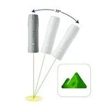
FJD Trion V4E LiDAR Kit — Mobile 3D Scanner with Integrated RTK
The FJD Trion V4E LiDAR Kit is a mobile 3D scanning solution that combines the Trion V4E's RTK GNSS positioning with a professional LiDAR sensor to generate Real-time georeferenced point clouds . It's the ideal choice for facade surveys, outdoor BIM, and underground utility mapping, where a 3D model that can be immediately used in CAD/BIM/GIS workflows is needed.
One Kit, Two Configurations
- V4E LiDAR Combo (with GNSS): georeferenced point clouds with real coordinates for external surveys
- V4E LiDAR (without GNSS): optimized for indoor surveys, lightweight and with quick setup
Dense and Real-Time Scanning
The sensor acquires 154,000 points per second with 360° horizontal FOV and -10° to +60° vertical FOV. The accuracy of the point cloud is 1 cm relative / 3 cm absolute post-processing, and 5 cm in real time during acquisition. The detection range is up to 50 m (target at 90% reflectivity).
Portability and Operational Simplicity
With about 890 g of weight and over With 5 hours of battery life , it's designed for intensive operating sessions without tiring the operator. Setup takes less than 60 seconds and is compatible with iOS (iPhone 15+) and Android (Galaxy S20+), with over-the-air firmware updates.
Flexible Workflow
The data is processed in the field on tablets via FJD Trion Model , generating point clouds, BIM-ready files and meshes. Synchronization with FJD Trion Cloud enables rapid sharing and review across distributed teams.
Application Scenarios
- Survey of facades and architectural heritage
- Outdoor and as-built BIM
- Mapping of underground utilities and infrastructure
- Interior surveys (offices, technical rooms, warehouses)
- Construction site and progress monitoring
Technical Specifications
| Parameter | V4E LiDAR Kit |
|---|---|
| Weight | ~890 g |
| Dimensions | 137 × 155 × 250 mm |
| Laser wavelength | 905 nm ±5 nm |
| Eye safety class | Class 1 (IEC 60825-1:2014) |
| Point cloud output | 154,000 points/s |
| Sampling frequency | > 200 kHz |
| Detection interval | 0.05–50 m (90% refl.) / 0.1–25 m (10% refl.) |
| Horizontal FOV | 360° |
| Vertical FOV | -10° to +60° |
| Real-time precision | 5 cm |
| Post-processed accuracy (relative) | 1 cm |
| Post-processed accuracy (absolute) | 3 cm |
| Autonomy | ≥ 5 hours |
| Recharge | ≤ 3 hours — 5V/3A |
| Drums | 3.6V / 6,700 mAh |
| Data port | USB 3.0 |
| Firmware update | OTA |
| iOS Compatibility | iPhone 15+ |
| Android Compatibility | Galaxy S20+ |
| Operating temperature | -10°C / +60°C |
| Assembly | 5/8" threaded connection |
| GNSS (Combo) | Integrated RTK V4E/V4E Pro |
Shipping and Warranty
Shipping and Warranty
All products available in stock will be delivered with an average timing of 24/48 hours.
Italy warranty with dedicated consulting support, contact us!