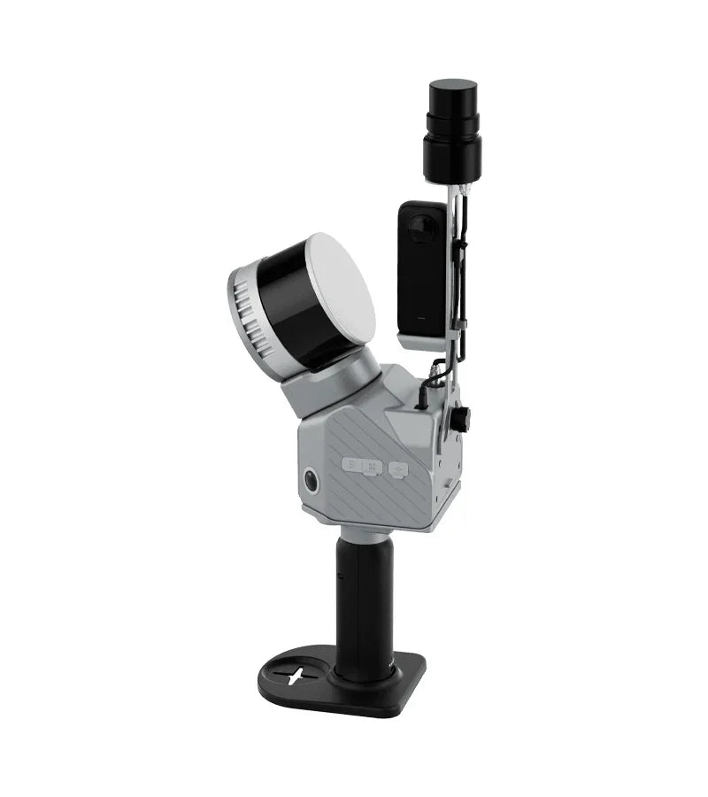
FJD Trion S2 LiDAR SLAM
FJD Trion S2 LiDAR SLAM
Couldn't load pickup availability


The LiDAR SLAM handheld device can capture up to 320,000 points per second with a scanning range of up to 120 meters. Ideal for indoor and outdoor surveys, it ensures georeferenced colored point clouds.
High-Precision LiDAR SLAM
FJD Trion S2 leverages SLAM (Simultaneous Localization and Mapping) technology to capture extremely detailed 3D point clouds. With a speed of 320,000 points per second, this scanner is perfect for topographic, architectural, and industrial surveys.
High Data Acquisition Capability
Walk and scan with the FJD Trion S2 LiDAR Scanner while viewing real-time point cloud data on your mobile device via Trion Scan.
Analyze the Point Cloud
Thanks to its 120-meter scanning range, the FJD Trion S2 accurately captures every detail of the surrounding environment, even in difficult conditions. Perfect for building mapping, urban surveys, and construction projects.
Easy to Use and Transport
With a compact and lightweight design, the FJD Trion S2 weighs only 2 kg, making it ideal for manual, vehicle-mounted, or drone-mounted surveys. Its portability facilitates use on construction sites, indoor environments, and complex areas.
Support for over 8000 Coordinate Systems
Eliminate the need for manual conversions thanks to compatibility with more than 8000 coordinate systems, ensuring a faster and more efficient workflow.
FJD Trion Scan: Real-time Point Cloud Visualization Software
Enhance your scanning experience with the FJD Trion Scan software. This real-time visualization software can help you monitor the scanning process, thus ensuring complete data acquisition in one scan.
Advanced Data Processing with FJD Trion Model Software
Thanks to the FJD Trion Model software, it is possible to analyze the data collected in the field, generate 3D meshes, and create optimized CAD and BIM models. This accelerates the analysis process and reduces processing times. Discover the two available versions and additional modules (for the Basic version only):
FJD Trion Model (Basic version) is the essential software for processing and analyzing 3D point clouds. Designed with an intuitive interface and powerful algorithms, it simplifies every phase of your work, from data management to final processing, ensuring precise and professional results.
Additional modules:
- FJD Trion Model Permanent Drawing module (Upgrade) is the module designed to create technical drawings, sections, entities, and CAD analyses of surveys from 3D point cloud data processing
- FJD Trion Model Permanent Forest module (Upgrade) is a module designed for automatic extraction of forest data and vegetation analysis from point cloud processing, improving efficiency and reducing costs and environmental impact.
- FJD Trion Model Permanent Site Survey (Upgrade) is the module designed for forensic applications and the precise management of road accidents. Thanks to advanced features for data collection and processing, this module allows for accurate reconstruction of accident scenes and spatial analysis, essential for public safety and investigations.
Technical Specifications
| Features | Details |
| Relative Accuracy | 1.2 cm |
| Absolute Accuracy | 3 cm |
| Points per second | 320,000 |
| Scanning Range | 120m |
| Weight | 2 kg |
| LiDAR FOV | 360° × 59° |
| Channels | 16 |
| Battery Life | 3h |
| Internal Storage | 512 GB |
| Point Cloud Format | .las / .ply / .pts / .e57 |
| Software | FJD Trion Scan and FJD Trion Model |
In the Box:
– 1x SLAM FJD Trion S2
– 2x removable rechargeable batteries
– 1x charger
– 1x base
– 1x system with 360° camera and RTK module
– 1x cable for 360° camera
– 1x cable for RTK module
– 1x mobile phone holder
– 1x target kit
– 1x certificate
– 1x warranty
– 1x cleaning cloth
NRTK Correction Service Included (Optional)
With the TruePoint CM (1 YEAR) option, you get maximum centimeter precision guaranteed on all constellations (Full GNSS). An unlimited NRTK correction service for 12 months, ideal for working immediately without interruptions and with maximum reliability.
Shipping and Warranty
Shipping and Warranty
All products available in stock will be delivered with an average timing of 24/48 hours.
Italy warranty with dedicated consulting support, contact us!