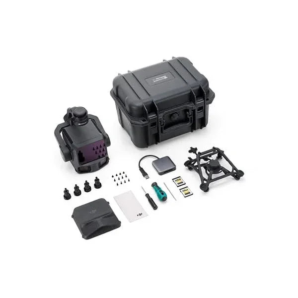
DJI Zenmuse L3 SP Plus
DJI Zenmuse L3 SP Plus
Regular price
€15.000,03 EUR
Regular price
Sale price
€15.000,03 EUR
Taxes included.
Shipping calculated at checkout.
Quantity
Couldn't load pickup availability


1535 nm long-range LiDAR system with dual 100 MP RGB cameras. High precision, high penetration and coverage of up to 100 km² per day.
Complete solution with 1 year DJI Care Enterprise Plus included.
⚠️ Compatible with DJI Matrice 400 (Not compatible with M300/M350 RTK)
The Zenmuse L3 is DJI's first long-range, high-precision aerial LiDAR system, designed for GIS operators, large-scale topographic surveys, critical infrastructure, and professional geospatial missions.
Key features
- The system integrates a 1535 nm wavelength LiDAR module that allows a range of up to 950 m even on surfaces with 10% reflectivity.
- Pair of 100 MP RGB cameras each (4/3″ sensor) with mechanical shutter, ideal for high-resolution and true-color mapping.
- High precision: for example, at 120 m flight altitude, the vertical RMSE accuracy is approximately 3 cm, and horizontal approximately 4 cm.
- Daily coverage of up to 100 km², allowing efficient and large-scale surveys.
- Multi-return support up to 16 returns, improving vegetation penetration and ground point density.
- High-precision POS (Positioning and Orientation System) and integrated 3-axis stabilization (gimbal) for compact and operational installation.
- Compatibility: designed for quick mounting via SkyPort attachment on the DJI Matrice 400 drone (note: not compatible with M300/M350 RTK).
Operational advantages
- Maximum efficiency: thanks to its extended range and high data acquisition speed, it allows covering large areas in less time compared to conventional systems.
- High resolution and color quality: the 100 MP cameras provide detailed RGB images, perfect for improving point cloud classification and interpretation.
- Topographic precision: the LiDAR + POS combination guarantees data that meets high requirements in topographic, infrastructural, and environmental surveys.
- Penetration and versatility: the 1535 nm LiDAR module improves penetration under vegetation and in difficult conditions, making it also suitable for power line inspections and engineering surveys.
- Integrated workflow: Part of the DJI Enterprise ecosystem (mission planning, acquisition, processing), facilitating integration into professional workflows.
User indications
- Exclusive mounting on DJI Matrice 400: ensure compatibility and configuration of the aircraft.
- To achieve maximum accuracy and performance, plan appropriate altitudes (e.g., 120-300 m) and optimal light and reflectivity conditions.
- Use compatible software (e.g., DJI Terra) for point cloud processing and GIS/archaeological workflows.
- Consider environmental conditions: the hardware is designed to operate in a wide thermal and environmental range.
Shipping and Warranty
Shipping and Warranty
All products available in stock will be delivered with an average timing of 24/48 hours.
Italy warranty with dedicated consulting support, contact us!