Compact and portable
Foldable for easy storage

Couldn't load pickup availability


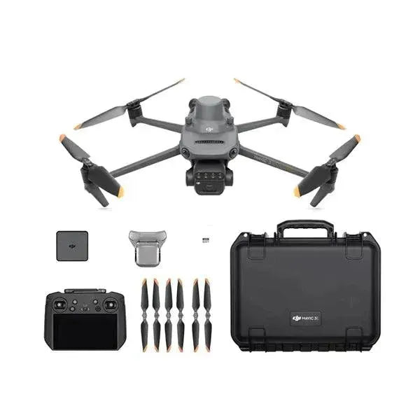
Compact and portable solution for precision agriculture, combines a 20MP RGB camera, 4/3 CMOS and mechanical shutter with a 5MP 4-sensor Multispectral camera for crop analysis: flight time 43 minutes
Including 2 years Care Enterprise (Basic)

Effective aerial surveying requires seeing the invisible. That's why the Mavic 3 Multispectral has two ways to see. It combines an RGB camera with a multispectral camera to scan and analyze crop growth with complete clarity. Crop production management requires precision and data, and the Mavic 3M delivers both.
Foldable for easy storage
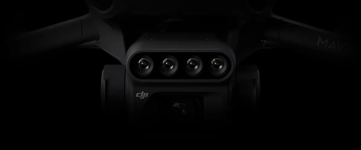
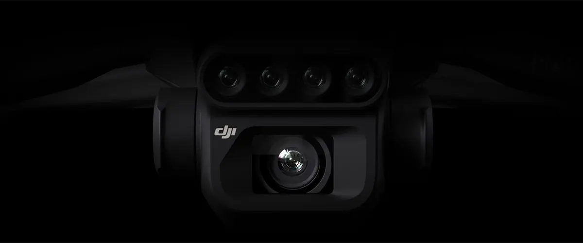
4 × 5 MP
G/R/RE/NIR
20 MP
4/3 CMOS, mechanical shutter
Omnidirectional obstacle avoidance
Transmission distance of 15km
Millimeter RTK positioning
Time synchronization in microseconds
Up to 2 square kilometers per flight
New upgraded imaging system with a 20MP RGB camera and 4 x 5MP multispectral cameras (Green, Red, Red Edge and Near-Infrared). Enables applications such as high-precision aerial surveying, crop growth monitoring and natural resource surveys.
860nm ± 26nm
730nm ± 16nm
650nm ± 16nm
560nm ±16nm
20MP image sensor
The fastest shutter speed
High speed shooting when using RGB camera
The built-in sunlight sensor captures solar irradiance and records it in an image file, allowing for light compensation of the image data during 2D reconstruction. This results in more accurate NDVI results, as well as greater accuracy and consistency of the data acquired over time.
Mavic 3M with RTK module for millimeter-precision positioning. The flight controller, camera, and RTK module synchronize in microseconds to precisely capture the center position of each camera's images. This allows the Mavic 3M to perform high-precision aerial surveying without using ground control points.

Cruising time
A single flight can complete mapping operations over an area of 2 square kilometers.
High efficiency fast charging
Aircraft
O3 transmission integrates two transmit signals and four receive signals to support ultra-long transmission distance of 15km.
The aircraft is equipped with multiple wide FOV vision sensors that accurately detect obstacles in all directions for omnidirectional obstacle avoidance. Aerial terrain follow surveys can be easily performed in steep terrain.
Mavic 3M is capable of automatic field exploration. Field exploration images support uploading to DJI SmartFarm Platform 6 in real time via a 4G network. It can detect anomalies such as emergence shortages, weed infestation and crop lodging in a timely manner. It can also conduct intelligent analysis such as cotton seedling identification and rice production tests using AI identification for real-time sharing of crop growth information, agronomic activity guidance and easy management of 0.7 square kilometers of farmland by one person.

Mavic 3M can also be used in environmental and natural resources surveys, such as water enrichment monitoring, forest distribution surveys, urban green areas and more.
Mavic 3M can be directly connected to a third-party cloud platform via the built-in DJI Cloud API of Pilot 2 based on the MQTT protocol. There is no need to develop a separate app to enable the transmission of UAV equipment information, live streaming, photo data and other information.
Mavic 3M supports Mobile SDK 5 (MSDK5) with a completely open source production code sample. MSDK5 allows you to develop your own control app for UAV field patrols, intelligent surveys and other scenarios, for greater ease of use.
All products available in stock will be delivered with an average timing of 24/48 hours.
Italy warranty with dedicated consulting support, contact us!
Free express shipping for orders over € 499.
* For return terms and conditions, please visit our returns and refunds policy.
You can ask us for an invoice for your purchases! All the prices of our products already include VAT.
Proceed with checkout and select "Teacher's Card" as the payment method. Requests?