

Construction Management - DJI ENTERPRISE
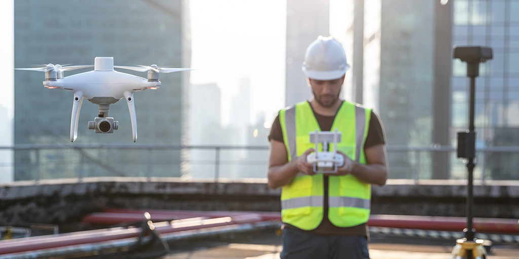
Site survey and key design benefits
Progress monitoring
Drone solutions, along with image stitching and 3D modeling software, help teams stay fully informed on site progress and resource allocation, keeping projects on time and on track.
Connection of the overhead power line
Heavy-duty lifting drones can carry cables to connect power lines across complex geographic areas such as valleys or rivers.
Condition during construction
By documenting data on-site throughout the project lifecycle, contractors can easily track changes and build models during construction that reflect the changes in detail before accepting the final design.
Plant digitization
Build high-definition 2D maps and 3D models of vertical plants and structures using survey drones, digitally illustrating the inspection results.
Progress monitoring
Traditional challenges in planning the construction of power lines
- The lack of accurate location data makes it difficult to align BIM projects, road vector maps and satellite imagery, which costs time and manpower.
- Without a real model, it is difficult to accurately account for a safe distance between power lines and nearby buildings during the design phase.
- BIM projects can be very different from the reality model, making it difficult to visualize and verify the project.
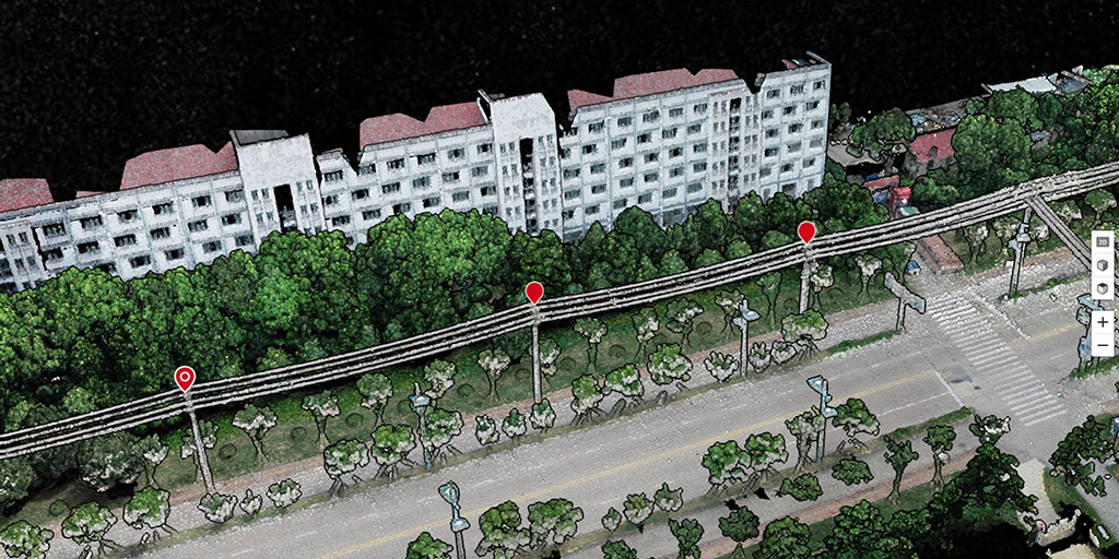
How drones improve the planning of the construction of power lines
- Quickly take off and fly over the construction site to create a 3D model of the area where a route might be planned.
- Create 3D models with accurate positioning data that can easily be adapted to BIM models to visualize designs.
- Generate better route designs using 3D models compatible with a variety of GIS software.
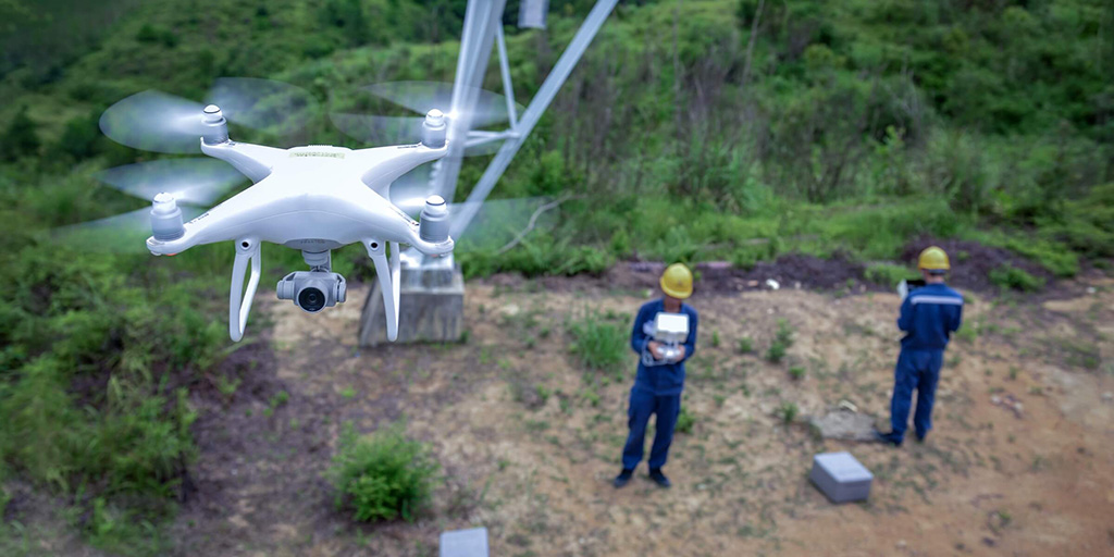
Site survey
Monitoring of ongoing traditional challenges
- It is difficult to keep track of power line construction projects as they are often spread out and involve many teams.
- Construction managers are unable to properly coordinate teams and ensure timely delivery of information due to the physical distance between the site and the command center.
- Fixed on-site cameras are unable to cover the entire site in detail, failing to capture critical progress information while creating many files that can be difficult to sort.
- Manual measurement of construction earthmoving is inefficient and produces poorly accurate results.
How drones help track progress
- Drones provide comprehensive site overviews and deliver accurate data on demand, keeping staff safe and improving efficiency throughout the project lifecycle.
- The drones are compact yet powerful, take minutes to set up, and can stream footage to the command center using DJI FlightHub, enabling timely information delivery and coordinated decision making.
- Earthmoving and material drone measurement data helps to accurately estimate workload and update project progress.
Connection of the overhead power line
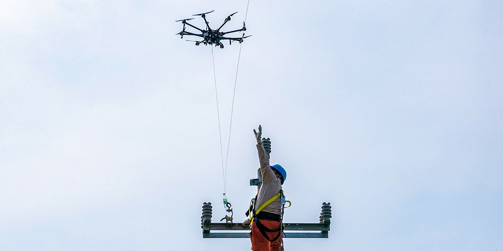
Traditional challenges in stringing overhead power lines
- Manually configuring cables in rough terrain such as rivers and valleys can be challenging, dangerous and time-consuming.
- Helicopters can be used, although they are expensive, have restrictions on take-off locations, and can be dangerous for the operator.
How drones line up power lines
- Drones can carry and connect power lines across mountain ranges and rivers, being able to take off and land in flexible locations and operate in high altitude locations.
- Drones can be controlled to operate accurately while following a set flight path through obstacles, improving flexibility and operational safety.
- Drones are efficient and economical, especially for remote regions.
Condition during construction
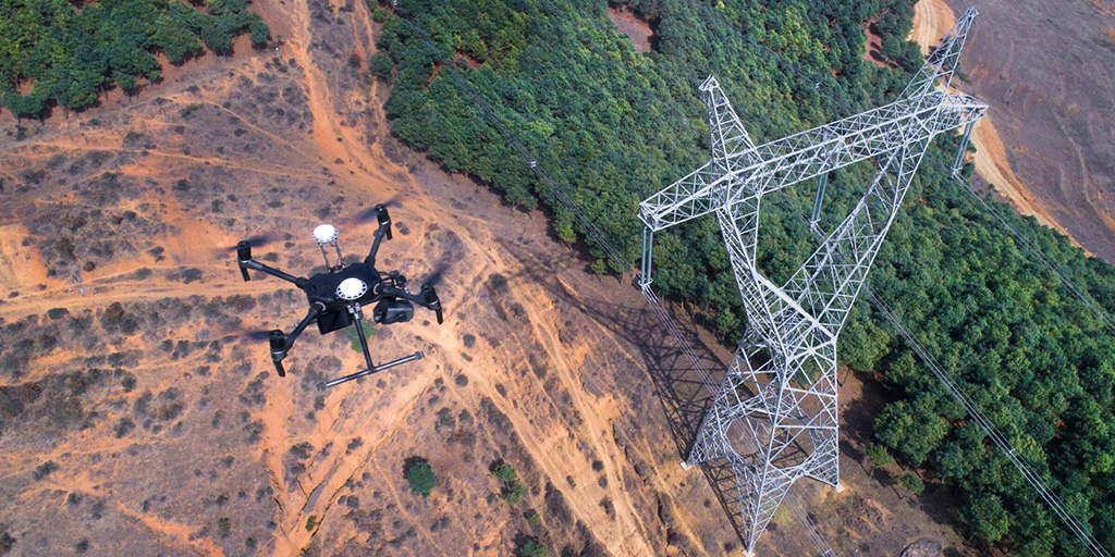
Traditional challenges in plans during construction
- Verifying project details sometimes requires staff to climb the pylons, which can be dangerous and time-consuming.
- Without climbing the pylons, it can be difficult to verify that all project requirements have been met based solely on observations from the ground.
- Documentation made by different team members is not consolidated or even digitized, making it difficult to fill in the feedback or the acceptance process.
How drones improve plans during construction
- Drones provide comprehensive inspection data on structures such as transmission towers, covering multiple angles without losing any detail.
- Drones can be used quickly, saving time and manpower while keeping staff safe.
Resource digitization
Traditional challenges in the digitization of resources
- Traditional sensing equipment can be cumbersome, expensive, and difficult to maneuver in remote areas.
- The learning curve on traditional sensing equipment is steep. Professionals are often hired to manage and analyze the data, incurring additional costs.
How drones digitize resources
- The drones are portable and flexible and can be used in remote areas such as mountains or in forests.
- Drones are much more affordable than traditional sensing equipment, while being easier to use and extract useful information.
- Drone data can be used to create topographic-grade 2D and 3D models, providing crucial data for automated inspections and more.

 https://www.instagram.com/3digital.tech/