

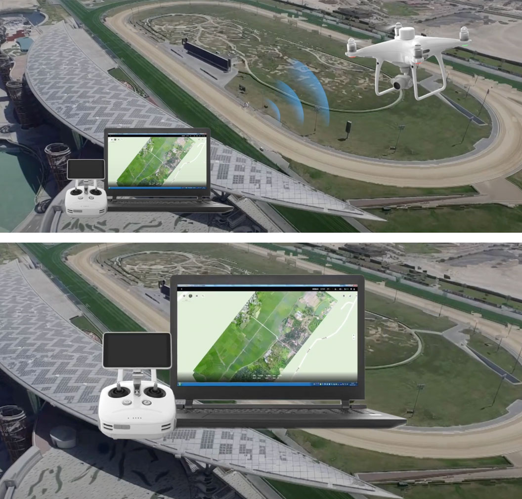
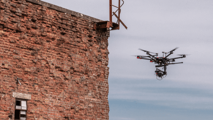
DRONES FOR PHOTOGRAMMETRY
HOW ARE DRONES BENEFITING TOPOGRAPHERS?
Collect data five times faster than traditional methods.
Increase efficiency and improve safety
Using a drone for surveying work has many benefits - it helps you acquire accurate data quickly, safely and economically, which in turn can improve decision making and provide vital information.
Thanks to their ability to acquire data from above, drones have been successfully integrated into surveying workflows to perform land surveying, photogrammetry, 3D mapping, topographic surveying and more.
Drone surveys can benefit from many applications in different sectors, such as construction, mining and aggregates, agriculture, urban planning and land management, public safety and environmental research.
Data acquisition with a drone is up to five times faster than land-based methods and requires less manpower.
But what is a drone survey, what data can you collect from your unmanned aircraft, how can it help you, and what are the best drones to use for this type of mission?
“What would have taken the surveyors about eight hours, I took about two hours with the drone. You also have the cost savings of paying one person instead of a three-man crew . The combination of surveying, drones and CAD information allows us to visualize our designs in ways never seen before. We provide our team with the big picture and information they need to share information more effectively and make better decisions . "
Michael Lambert, VDC Manager at Chasco Constructors
“The stocks are spread over a large area and are of various sizes and heights. The detection with a drone is 90% faster . A miner would normally walk the work area with a surveyor's total station and measure not only the stock area, but also the various heights of the material. But above all, i drones significantly reduce the number of workplace hazards employees are exposed to ”.
Alexander Tubaltsev, chief miner, Ferrexpo Yeristovo Mining
WHAT IS A DRONE DETECTION?
Conduct overhead surveys with UAVs.
Put simply, a drone survey is an aerial survey conducted by a drone and is becoming more and more popular.
Using downward-facing sensors, such as RGB or multispectral cameras or LiDAR payloads, drones can quickly acquire a large amount of data. An analysis showed that drones can collect data 97% faster than manual methods.
This data can be used to create a variety of assets, such as 3D maps and elevation models, and extract valuable information such as highly accurate measurements and volumetric calculations.
This information helps make informed decisions and provides valuable information, including identifying errors or problems, keeping up with the progress of a project, and monitoring plant health.
Drone surveying has become such a valuable tool, it is used for land surveying, rooftop inspections, bridge / building surveys, infrastructure maintenance and on construction sites.
 "Drones enable companies to create highly accurate point clouds and maps, discover costly errors on site and anticipate planning delays, saving up to tens of thousands of pounds a week."
 Richard Clement, Komatsu
“By using drones, we have created a much more efficient process. We can literally take weeks off the schedule, our projects are of much higher quality than before and are safer ”.
Jim Gorrie, CEO Brasfield & Gorrie
WHY USE A DRONE FOR DETECTION?
Improve efficiency, save money and improve security.
Promote business workflows
There are many advantages to using a drone to make a survey, especially compared to traditional methods.
Simply put, drones are more efficient than traditional ground-based methods, improve workplace safety, and are able to reach areas that would often be prohibited.
These benefits drive workflows and business results and maximize ROI.
“Drone footage helps simplify project management. It took my team just a few days to complete site mapping with drones, speeding up project planning with more accurate site data. "
Grant Hagen, VDC Director, The Beck Group
Find out how drones can transform your detection missions:
More security
Drones greatly increase safety. Why send you to inspect a roof or climb on an escort when a drone can do the job for you?
Using drones for survey work also means you don't need to put out as many ground control points - in some cases, you don't need them. Not only is it a great time saver, but it's also a huge safety benefit by reducing the need for staff to access potentially dangerous areas of your work site.
Wayne Hughes, Balfour Beatty drone pilot, said: “Drones make quantity acquisition and inventory measurements safer. Drones take people away from places where they could be in danger and it means we don't have people bypassing the supplies. Instead, drones can fly over the site and then generate a model, which we can review in the office ”.
More efficient and cheaper
Acquiring data with a drone is much faster than using techniques in the field and requires less manpower. Using RTK (real-time kinematics) or PPK (post-processed kinematics) technology also saves the arduous and sometimes dangerous task of placing large numbers of ground control points.
For example, Balfour Beatty used drones in a Smart Motorway development, including inventory measurement. The company said it would take a surveyor about a day to measure inventory and process data using traditional handheld equipment. But using the drone, the complex could be flown in 15 minutes, and the model could be processed in about two hours.
Using drones means delivering survey results faster and, consequently, at a lower cost.
Russell Byrd, Virtual Design and Construction Coordinator at Brasfield & Gorrie, said, "Our project and safety teams can now complete walkthroughs remotely, increasing safety and awareness without ever having to go on site."
Reach inaccessible places
Drones can reach places that humans cannot. They can also fly at a much lower altitude than manned aircraft or satellite imagery. This is a particular advantage if you have cloud cover.
Highly accurate data that can be shared
Drones collect highly accurate data.
A drone flight produces thousands of measurements, which can be represented in different formats (orthomosaic, point cloud, DTM, DSM, contour lines, etc.). Each pixel of the produced map or point of the 3D model contains 3D geographic data.
Basically, this information can be stored and shared quickly, which aids in team-wide decision making and communication.
Monitor the progress of a construction site and improve resource productivity
Drones provide an overhead view of a site, providing a complete snapshot of the area and offering useful insights.
Running regular flights through a project allows your team to track progress and identify any errors or problems. Basically, these problems can be spotted early, helping you make quick and informed decisions.
Drones offer a unique view, which you wouldn't get from the ground, and are able to cover an area faster and safer than traditional ground-based methods.
Matthew Forster, Project Engineer for Choate Construction, said: “The drone maps give my team a bird's eye view of the site, which looks very different from being on the ground. It gives them a complete picture ”.
DRONES FOR DETECTION - USE CASES
Learn more about how professionals benefit from surveying drones.
Balfour Beatty deploys drones on a smart highway
Balfour Beatty used drones, including the DJI Phantom 4 RTK, during a £ 212 million Smart Motorway upgrade on the M6.
The international infrastructure group used UAS for faster stock measurements, informational reports on aircraft progress and access to hard-to-reach areas.
The use of drones has helped the company improve safety, increase efficiency, collect data faster, improve resource productivity, and achieve highly accurate results.
Drones have proven their worth when it comes to measuring inventory volumes; not only contribute to efficiency, but also improve safety.
“Drones save a lot of time. Let's take the recycling compound for example. If we were to measure inventory with traditional survey tools, it would take much longer to measure the site and collect data, while drones allow the team to fairly make quick measurements of different types of materials and earthworks. "
Craig Matthews, Principal UAS Manager for Balfour Beatty
Atkins uses a bespoke DJI drone for detection
Greater efficiency, greater safety and reduced costs: World-renowned engineering and design company Atkins is benefiting from drones, including a custom-built DJI M600 Pro with a Sony RX1R II sensor.
Pairing the 42MP high-tech camera with the drone and a high-precision Global Navigation Satellite System (GNSS) provided a bespoke solution to meet Atkins' specific tracking requirements and enabled the company to acquire and generate accurate and repeatable data.
The company says that, compared to traditional survey methods, drones dramatically reduce the amount of time the survey team spends walking around the site, reducing or even eliminating the time spent working in potentially hazardous environments.
“While we still use airplanes and helicopters in many of our larger projects, drones allow us to mobilize faster and reduce costs when surveying small and medium-sized sites. We are also able to capture higher resolution images, down to less than cm from drones compared to 2-3 cm from manned aircraft, and combine mapping and inspection surveys in the same site visit, increasing efficiency. "
James Fleming, geomatics consultant (UK and Europe), at Atkins
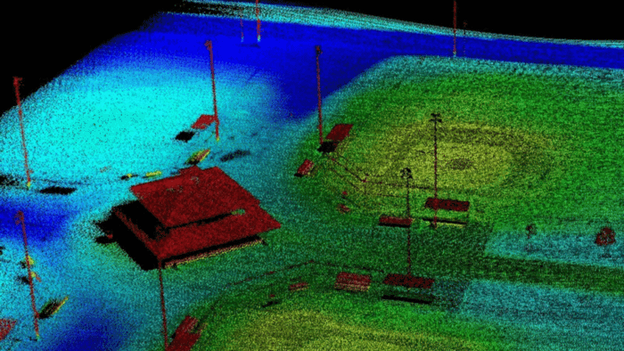
DJI Phantom 4 RTK used for breakwater survey
Terra Drone Europe (formerly Skeye) used the DJI Phantom 4 RTK to carry out a major breakwater survey in Central America.
Terra Drone Europe collaborated with the Dutch company Deep for the works, which took place in Guatemala.
Over the past six years, Terra Drone Europe has undertaken many sea-based collaborative aerial surveys to create unique datasets in extremely remote or difficult to access areas.
By combining hydrographic survey data with aerial survey data, it is possible to create a seamless 3D model showing features above and below the water level.
This uninterrupted view provides meaningful insights into complicated spaces, and the data produced supports key decision making.
“The DJI Phantom 4 RTK was chosen for its high accuracy in determining photo positions. We believe and have shown that the number of ground control points can be significantly reduced by using this drone ”.
Terra Drone Europe
DJI drones transform visual sensing work
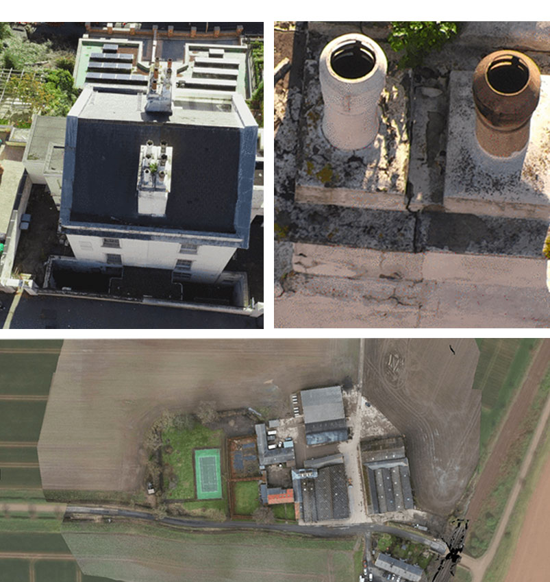
Quayle Industries uses the DJI M210 V2 series with the DJI Zenmuse Z30 zoom payload, as well as the X4S and X5S imaging cameras, for a variety of drone surveys, including roof inspections, power cable checks, and tracking progress of the site.
Using DJI technology, Quayle Industries is able to do their jobs faster, easier and safer than traditional methods, keeping people away from potentially dangerous situations, accessing hard-to-reach areas, and providing unique perspectives.
For example, Quayle Industries used the M210 V2 with the Z30 for this roof detection, pictured on the right. The image on the left shows the view from the drone, high above the building, while the image on the right is a crystal clear image of two of the chimneys, captured using zoom.
This method has numerous advantages. Firstly, the inspection can be completed without having to send team members to the roof, improving safety.It is also a great time saver, as information can be gathered much quicker with a drone than from someone having to board. on top of the building to inspect the scene. This also helps with costs.
And while this technique is time-effective, it doesn't skimp on quality, as the Z30 detects every detail of the two fireplaces, which in turn helps with inspection.
“If you need an asset inspection, drones can take high definition photos that show the condition of the property. This is perfect for roofs and other difficult to access areas. We provide high definition photographs or 4K video of any infrastructure that needs to be checked for damage. By using a drone, you eliminate the need for elevated work platforms or scaffolding, reducing costs, time and, most importantly, risks. The zoom level achievable with the Z30 is exceptional. "
Quinton Quayle, Quayle Industries
WHAT KIND OF RESULT CAN YOU GET WITH A DRONE DETECTION?
Transform drone data into a range of digital assets to provide you with key information.
Improve your workflows
Depending on your choice of data sensors and software, drone detection can produce a variety of results with use cases across many industries. Here is a selection:
2D map
Survey software can merge hundreds or thousands of digital photos captured by your drone and produce high quality 2D orthomosaic maps.
Having a 2D map can be useful for a variety of reasons and can be used in a wide range of industries, including construction and infrastructure.
By having a drone take hundreds or thousands of photos, you will not only create a complete map, but you will also have a large collection of individual high definition images.
These maps and images give you a real-world view, helping you quickly make decisions and analyze how a project is progressing.
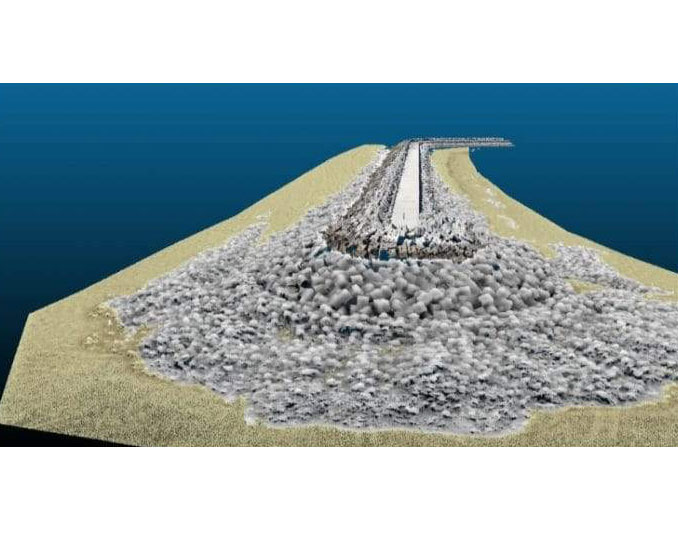
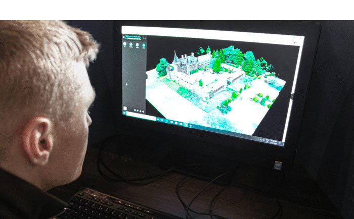
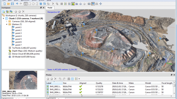
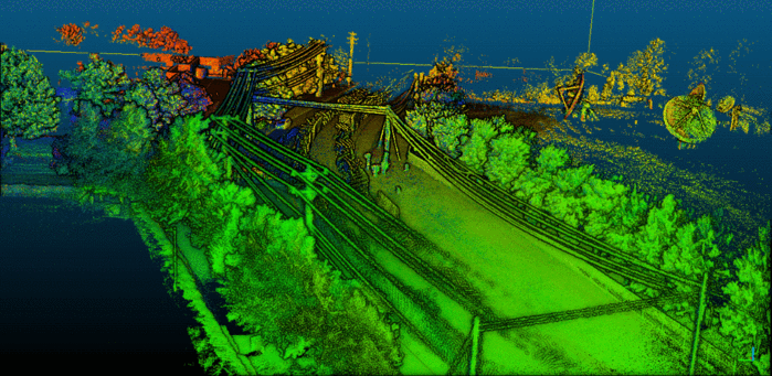
3D mapping
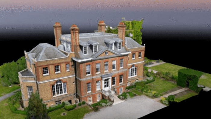
A point cloud is a 3D view made up of thousands or even millions of georeferenced points. Point clouds provide high-resolution data and offer an interactive 3D model with real-world images. This will help you inspect your job site, for example.
Using 3D data allows you to produce a digital surface model (DSM), a digital elevation model (DEM) or a digital terrain model (DTM).
Point clouds can also be used to develop digitized models of structures for CAD and BIM purposes, something that is at the forefront of modern construction.
Volumetric detection
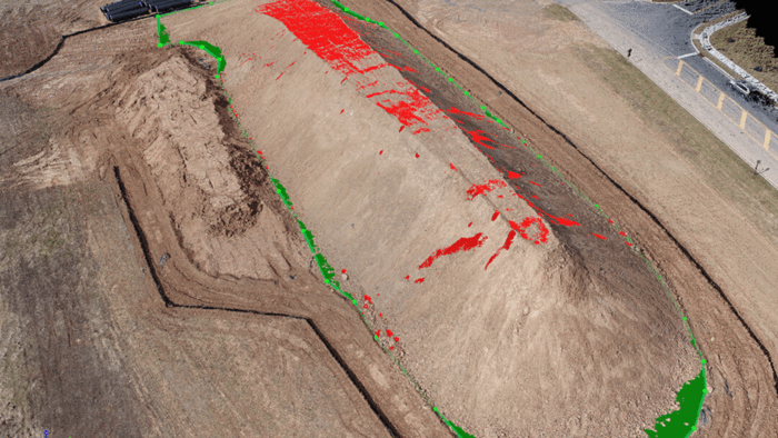
Drones can be used to create volumetric models, useful for example for stock measurements.
Traditional stock measurements when using GPS or total stations are inhibited by the limited sampling data that can be collected. Instead of using a point grid with a point every 5 meters, a drone can collect a point with a sample distance from the ground of 1 cm creating a much better and more accurate sampled dataset.
Thermal detection
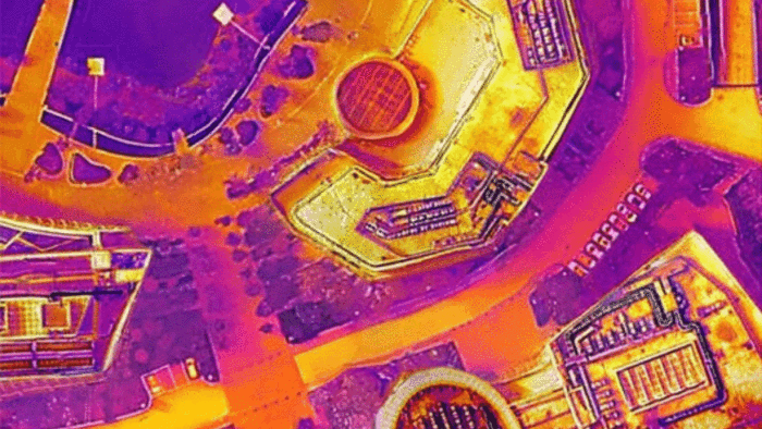
Detect with a thermal imager and quickly identify targets with anomalous thermal signatures.
Thermal investigations can help identify heat losses in order to improve energy efficiency; it can identify water leaks or moisture infiltrations or faults in wiring and other electrical components.
LiDAR map
Equip your drone with a LiDAR camera to produce a high-density point cloud, giving you useful information about the shape of the Earth and its characteristics.
A LiDAR map is useful for industries such as forestry and agriculture / landscaping.
Visual detection with drone
Drones can be used to produce visual reliefs. You can perform a visual drone survey and a drone inspection to check power lines and roof inspections.
Using a drone to do this is more efficient, cheaper and safer than traditional methods.
DETECTION DATA PROCESSING WITH DRONES
Maximize your data collection.
Generate digital models to drive business results
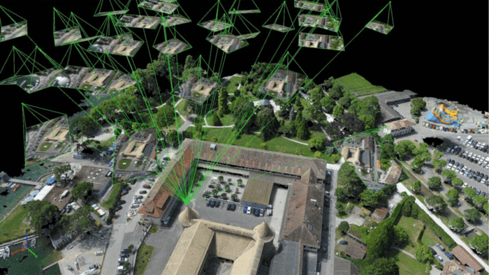
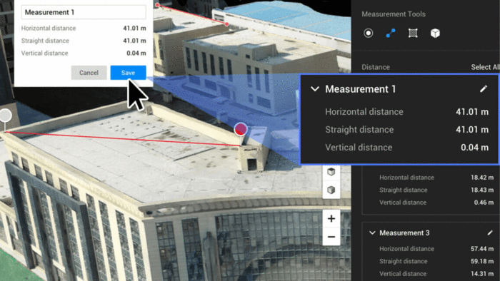
When surveying with drones, images of the terrain are taken from multiple observation points. By processing these images, photogrammetry software can then create orthomosaics and 3D models, from which it can accurately measure distance, as well as surfaces and volumes of physical objects.
Drone mapping software is a key part of your drone tracking operations, turning the data you have collected into meaningful assets that aid decision making.
Image processing can be a lengthy process depending on the number of images and the performance of your computer.
WHAT IS THE BEST DRONE MAPPING SOFTWARE TO USE?
A selection of industry-leading solutions.
Drone mapping and fleet management software are essential components of any successful UAV detection program.
Each solution has its own range of features that can benefit the end user.
Drone Mapping Software
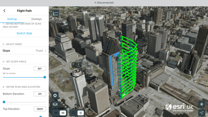
Esri Site Scan for ArcGIS
Esri Site Scan for ArcGIS is particularly suited to the AEC industry.
This cloud-based software suite provides an end-to-end drone mapping workflow, including drone flight planning, fleet management, image processing and data analysis capabilities.
The main features include:
- Repeat flight plans to collect accurate data and keep up to date on progress on your job site.
- Process images in the cloud (EU-based) to create detailed and accurate 2D maps and 3D reconstructions.
- Use a range of analytics and measurement tools to gather meaningful information to help shape informed decision making.
- Simplified data sharing and analytics.
- Manage your fleet of drones to ensure the smooth and safe conduct of your UAS operations.
DJI Terra
DJI Terra transforms drone data into 3D digital models and maps for easy analysis and decision making.
Run maps in real time and generate high-quality 2D and 3D reconstructions and measurements, among other things.
An Electricity license is also available, to provide new optimizations for power line modeling, helping business users create detailed 3D reconstructions of thin power lines.
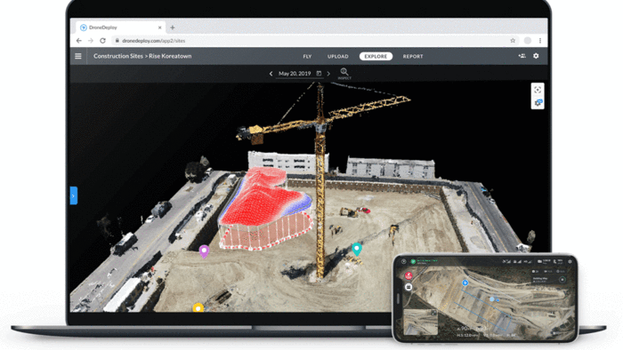
DroneDeploy
DroneDeploy is a comprehensive mapping tool with a range of features to maximize drone detection missions.
Automate maps and photo flights for DJI drones using the DroneDeploy mobile app; create accurate, high-resolution 3D maps, reports and models, as well as real-time 2D live maps for immediate analysis.
Enable teams with unlimited cloud image processing and one-click collaboration, export and integration options.
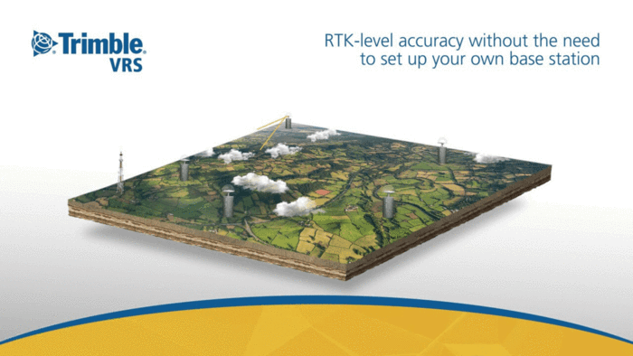
Trimble VRS
Trimble VRS offers instant access to RTK positioning services using a network of permanent and continuously operational reference stations.
Trimble VRS reliable network ensures uninterrupted connectivity, so you don't have to worry about lost signals.
Trimble VRS is easy to use (just connect, correct and measure), allows instant initialization (full accuracy instantly under optimal conditions), and is a high precision instrument (accuracy greater than 2cm for jobs that require the highest level of accuracy positioning).
Pix4D
Pix4D was designed to allow professionals to generate high quality 2D and 3D data through the use of aerial imagery.
The photogrammetric aspect of the software uses images captured by UAVs to generate results ranging from point clouds to digital surface and terrain models, from orthomosaics to textured models.
Select the perfect flight plan for your project and monitor the image capture in real time.
Agisoft Metashape
Use Agisoft Metashape to perform photogrammetric processing of digital images and generate 3D spatial data for use in GIS applications.
The standard edition allows for panoramic stitching, 3D model generation / texture, dense point cloud generation and photogrammetric triangulation.
A Professional package is also available, with extended features such as 4D modeling, access to Python script to allow customization of processing workflows, and export of geo-referenced orthomosaic data.
AirMap JobSight
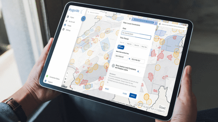
The AirMap JobSight platform offers a secure, reliable and accurate digital twin of airspace.
AirMap's airspace automation technology provides a common, real-time operational picture of low-flying airspace to all stakeholders, while AirMap's flight automation technology allows business operators to integrate drones into their operations .
Other highlights include AirMap's data flow engine that automates the entire data lifecycle of drone sensors.
Drone fleet management platforms
DJI FlightHub : Manage the entire operation of your drone using DJI FlightHub, including the Enterprise edition. If you are managing multiple drones and pilots, as you juggle multiple operations, DJI FlightHub will provide you with a live, complete picture of the entire drone program. Highlights include real-time communication with pilots during live operations; easy registration and management of the flight log; manage equipment, pilots and individual flights throughout your organization; and easy-to-use mission planning tools to increase efficiency.
DJI GS Pro : Enhance your drone operations with DJI Ground Station Pro (DJI GS Pro), an iPad app. GS Pro allows you to conduct automated flight missions, manage flight data in the cloud, and collaborate between projects to efficiently run your drone program. GS Pro allows you to backup flight data to the cloud; coordinate teams and designate roles for simplicity and clarity of the mission; and generate efficient flight paths and load the collected data into the reconstruction software to generate 3D maps.
Soarizon : This integrated software package allows operators to plan, fly, analyze and track their drone missions anywhere in the world, increasing the ease and effectiveness of commercial UAV programs. This secure and efficient ecosystem provides operators with advanced mission planning, airspace data and 3D visualization, risk assessment tools, NOTAMs and mapping capabilities, all in one place.
HOW ACCURATE IS A DRONE DETECTION?
Get centimeter-level accuracy.
You can rely on drone data
Drone detection solutions can produce varying degrees of accuracy, depending on the project requirements.
In an independent study by DroneDeploy, the DJI Phantom 4 RTK achieved a relative vertical accuracy of 2cm and a relative horizontal accuracy of 1.20cm.
An accuracy report with customer Heliguy Terra Drone Europe also showed that the DJI Phantom 4 RTK can achieve accuracy of 3cm-4cm without the need to lay any ground control points.
For some applications, such as crop growth control or construction progress, high relative accuracy is sufficient. For other jobs that also require absolute high accuracy, there are drones equipped with Real-Time Kinematic (RTK) and Post-Processed Kinematic (PPK) capabilities. When combined with some ground control points, detection accuracy can be achieved.
“Not only can you get accurate results, but in most cases using the Phantom 4 RTK for surveys will reduce the costs associated with traditional methods, including those spent on labor, hardware and software. This also goes hand in hand with the overall benefits our customers have gained, such as increased productivity, faster turnaround times, better collaboration and greater workplace safety. "
Verdict: DroneDeploy after testing the accuracy of the DJI Phantom 4 RTK
What is the distance of the sample to the ground (GSD)
Ground Sample Distance (GSD) is the terminology used to describe how much ground distance is displayed between each pixel center of the image. For example, if the GSD is 1.5cm, every single pixel on the image refers to 1.5cm square on the ground.
GSD depends on two factors:
- Flight Height: The higher you fly, the higher your GSD becomes.
- Camera Resolution: The higher the resolution, the better the ground detail that can be shown in the photograph, which means a lower GSD.
It is also important to remember that if your project requires specific accuracy, your GSD should not exceed it. For example, if you are aiming for a final relative accuracy of 2cm, your GSD should be no more than 2cm.
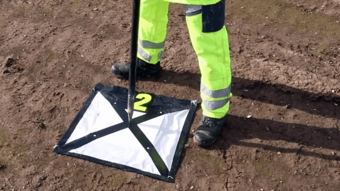
WHAT ARE THE GROUND CONTROL POINTS?
Helps to capture accurate drone data.
RTK can reduce the need for GCPs
When it comes to obtaining detection level accuracy from drone mapping, using GCP has traditionally been the primary method.
Ground Control Points - or GCPs as they are known - are marked points on the ground that have a known geographic location.
For aerial survey applications, GCPs are typically required as they can improve the positioning and accuracy of mapping results. In fact, the GCPs allow the survey drone to obtain fairly accurate data.
However, taking this approach has its drawbacks. This method can be laborious, as it requires the precise arrangement and geolocation of numerous checkpoints, and can require a great deal of preparation. In some cases, more time is spent laying GCPs than conducting the drone mapping itself.
There is a way to minimize or eliminate the need for GCP, which is to use corrective RTK and PPK technologies. And drones like DJI Phantom 4 RTK and M300 RTK benefit from this technology to simplify drone detection missions.
Taking this approach can eliminate, or certainly reduce, the number of GCPs needed. Using this technology can save 75% of the time and money spent on drone mapping setup, it has been estimated, and can lead to centimeter-accurate data.
“The unique selling point of the DJI Phantom 4 RTK is that it is able to record the exact set of coordinates at the time of image acquisition using RTK GNSS. This reduces the number of ground control points needed, reducing the amount of time it takes to be on site while maintaining the same level of accuracy. "
Terra Drone Europe Phantom 4 RTK Accuracy Report
PPK VS RTK
Which is best for your drone detection missions?
Drone pilots can take advantage of PPK (post-processed kinematics) and RTK (real-time kinematics) during surveying and mapping projects. But what's the difference?
RTK is a GPS correction technique that provides real-time corrections to location data when the surveying drone is capturing photos of a site. Real-time correction is a major industry advantage.
PPK is another GPS correction technology technique that works to correct location data, in the cloud after the drone data has been captured and uploaded.
In other words, this means that in terms of position correction, RTK does it during the flight, while PPK makes the changes later.
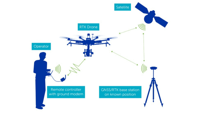
RTK has many advantages, such as aircraft millimeter accuracy during flight and accurate geolocation of information captured by the aircraft.
However, RTK requires a very specific base station and other equipment working together to process data in real time, and signals can be blocked resulting in loss of correction data. This is not a problem with PPK.
PPK also removes the requirement for GCPs saving additional time in the field.
SURVEY WITH AND WITHOUT RTK
Here is a breakdown of the benefits of using a drone with RTK, compared to relying only on ground control points or piloting a UAV without RTK.
Perhaps the best combination is to deploy a drone with RTK and a small number of strategically placed ground control points.
Having piloted the DJI Phantom 4 RTK, Terra Drone Europe believes that in some cases the accuracy that can be achieved without any GCP is less than 3-4cm, but when more accuracy is needed, it is advisable to use a number of control points - but it is still a reduction compared to traditional detection methods.
GCPS ONLY |
DRONE WITHOUT RTK |
DRONE WITH RTK |
DRONE WITH RTK + GCP |
|
|---|---|---|---|---|
Accuracy |
Tall |
Bass |
Tall |
The highest |
Speed |
Bass |
Tall |
Tall |
Medium / High |
Cost |
Tall |
Bass |
Bass |
Bass |
GCP only
- High accuracy
- Low speed
- Expensive
Drone without RTK
- Low accuracy
- High speed
- Low cost
Drone with RTK
- High accuracy
- High speed
- Low cost
RTK + GCP
- The highest accuracy
- Medium / High speed
- Low cost
PHOTOGRAMMETRY WITH DRONE VS LIDAR
Choose the right solution for your needs.
In drone detection missions, the choice between photogrammetry (above, right) and LiDAR (below, right) depends a lot on your mission and budget.
Drone photogrammetry is when a drone captures a large number of high-resolution images over a specific area. You can use these images to reconstruct the terrain in 3D using image overlay and sufficient ground control.
Photogrammetry is best for mapping, probing, mining, wide coverage combined with high horizontal and vertical accuracy.
In contrast, LiDAR (which stands for light sensing and beam) is a remote sensing technology that uses rapid laser pulses to map the surface of the earth.
LiDAR is useful when used to create high resolution digital surfaces, terrain and elevation models used for various business applications.
Both photogrammetry and LIDAR can provide remarkable levels of 3D model accuracy, especially compared to terrestrial sampling methods.
A big advantage of photogrammetry is that this technique not only generates accurate 3D models, but also full-color and high-resolution information for each point in that model, providing a clear visual context.
This makes interpretation and analysis of the results much easier than with a pure LiDAR point cloud.
However, when it comes to detecting dense soils, where light pulses can still penetrate between branches and leaves, LiDAR obtains highly detailed information.
This is a major advantage over photogrammetry, as photogrammetry can only produce accurate surveys when sparse vegetation is present on the site. Although LiDAR has similar limitations, in good conditions it can penetrate areas with up to 90% vegetation. (Photogrammetry approaches 60%).
One of the biggest differences between photogrammetry and LiDAR is the price.
Thanks to innovation, LiDAR has become a much more accessible solution than before. That said, it still comes at a price and is a more expensive solution than photogrammetry.
A drone-based lidar system can save you tens of thousands of pounds, while a DJI Phantom 4 RTK will cost a few thousand pounds and is easier to use.
LiDAR sensors for drones
LiDAR sensor for Zenmuse DJI L1 drone
The DJI Zenmuse L1 integrates a LiDAR module and a 20MP RGB camera, along with a high-precision IMU.
Designed exclusively for the DJI M300 RTK drone, the L1 is a robust and efficient LiDAR solution, capable of covering up to 2km² in a single flight and capable of achieving accuracies of 5cm (vertical) and 10cm (horizontal) at 50 m of flight altitude.
With a point rate of 240,000 points per second, which can be increased due to L1's ability to support up to 3 returns, L1 can be used to create highly detailed and dense point clouds.
Use Point Cloud LiveView to get point clouds in real time, while the RGB camera helps give color to your data. The RGB camera can also be used for photogrammetry missions.
L1 is a robust LiDAR solution, thanks to its IP54 rating, which ensures reliable performance in difficult weather conditions and allows for more opportunities to acquire data.
L1 can be used in conjunction with the drone detection software package, DJI Terra, for an end-to-end detection solution within the DJI ecosystem.
BUY DJI L1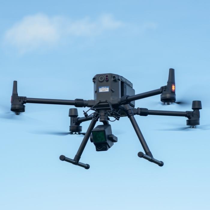
WHAT ARE THE BEST DRONES FOR DETECTION?
Next generation tools to maximize results.
As the world's leading drone manufacturer, DJI has built a range of aircraft to help transform surveying and mapping workflows and provide teams with accurate data they can trust.
Below is a selection of drones from the DJI ecosystem that will assist your mapping missions.
M300 RTK
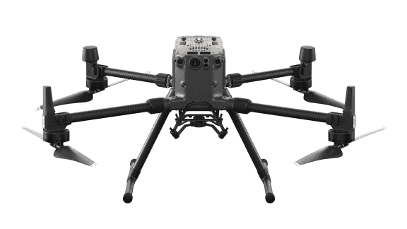
The M300 RTK is DJI's flagship drone.
It is IP45 rated, can fly for up to 55 minutes, can carry up to three payloads simultaneously, and has advanced security features.
For detection, pair the M300 RTK with the P1 or L1 payloads. The P1 is a high resolution 45MP full frame camera, ideal for photogrammetry. It combines a Lidar module, an RGB camera and a high precision IMU.
For greater mission efficiency, the M300 RTK can also be integrated with the H20 series; with the H20T with thermal capabilities, zoom, wide angle and laser rangefinder.
Phantom 4 RTK
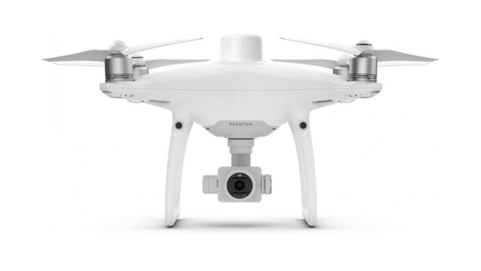
The DJI Phantom 4 RTK is a compact and precise low-altitude drone mapping solution.
Designed exclusively for aerial detection, its 1 ″ CMOS sensor can capture 20MP images.
The Phantom 4 RTK is capable of achieving a horizontal RTK positioning accuracy of 1cm + 1ppm and a vertical RTK positioning accuracy of 1.5cm + 1ppm.
A new RTK module is integrated directly into the Phantom 4 RTK, providing real-time positioning data at the centimeter level for improved absolute accuracy on image metadata.
Phantom 4 Multispectral
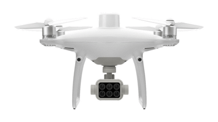
Collect accurate plant-level data using the high-precision DJI Phantom 4 Multispectral.
Access information gathered from an RGB camera and multispectral camera array with five cameras spanning the Blue, Green, Red, Red Edge and Near Infrared bands, all 2MP with global shutter, on a 3-axis stabilized gimbal.
Multispectral imaging measures bands of the electromagnetic spectrum other than visible light, and each band can be used to derive different information from the same image. Multispectral data can be used to obtain vital agricultural data.

 https://www.instagram.com/3digital.tech/