
Comparison between DJI Mavic 3 Enterprise Series VS M30 VS M300 RTK
The series Mavic 3 Enterprise , the M30 Series and the M300 RTK make up DJI’s premium Enterprise drone line. Each platform has distinct advantages and qualities: Find out which is best for your operations with our in-depth guide.
DJI has strengthened its Enterprise product line with the release of the Mavic 3 Enterprise series.
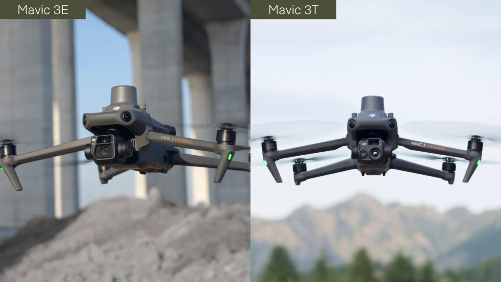
These drones, the Mavic 3E and Mavic 3T, join the M30 series and M300 RTK as DJI's premium commercial platforms.
Each aircraft has a specific user profile, from the compact and lightweight Mavic 3 Enterprise Series to the flagship M300 RTK with its unmatched versatility.
The choice depends on many factors, such as use case and budget.
This blog analyzes all these solutions, highlighting their main specifications and best applications, to help you make an informed choice on the optimal platform for your specific needs.
Key Specs
This table provides an overview of the key specifications of the Mavic 3 Enterprise series (Mavic 3E and Mavic 3T), the M30 series (M30 and M30T), and the M300 RTK.
| Mavic 3 Enterprise Series (Mavic 3E and Mavic 3T) |
M30 Series (M30 and M30T) |
M300 RTK | |
| Dimensions (L x W x H) |
Folded (without propellers): 221 x 96.3 x 90.3 mm; Unfolded (without propellers): 347.5 x 283 x 107.7 mm |
Folded: 365 x 215 x 195 mm; Unfolded (propellers excluded): 470 x 585 x 215 mm |
Folded: 430 x 420 x 430 mm; Unfolded (propellers excluded): 810 x 670 x 430 mm |
| Weight | DJI Mavic 3E: 915g; DJI Mavic 3T: 920g (without propellers and accessories) |
3.7 kg (including two batteries) | Approx. 6.3 kg (with two TB60 batteries, and single downward gimbal) |
| Max Take-off Weight | DJI Mavic 3E: 1,050 g; DJI Mavic 3T: 1,050g PSDK supported |
4 kg PSDK supported |
9 kg PSDK supported |
| Max Flight Time | 45 minutes | 41 minutes | 55 minutes (no payload); With payload: Depends on payload. Examples include H20T: 43 min; P1: Up to 44 min; L1: Up to 42 min. |
| Camera/Payloads | Fixed, multi-sensor payload. Mavic 3E: Wide + Tele; Mavic 3T: Wide + Tele + Thermal.Accessories can be added, such as RTK Module and loudspeaker. |
Fixed, multi-sensor payload.M30: Laser rangefinder + Wide + Zoom; M30T: Laser rangefinder + Wide + Zoom + Thermal. Third-party payloads, such as LP12 loudspeaker and spotlight, can also be used |
Interchangeable payloads, including third-party payloads. Can carry up to three at a time. Payload options include H20T (Laser rangefinder + Wide + Zoom + Thermal); P1 full-frame photogrammetry camera; L1 LiDAR and photogrammetry sensor; gas detection modules; speakers/spotlights; and agricultural sensors. |
| IP Rating | No | IP55 | IP45 |
| Operating Temperature | -10°C to 40°C | -20°C to 50°C | -20°C to 50°C |
| Max Speed | 15 m/s (Normal Mode); Forward: 21 m/s (Sport Mode) |
23 m/s | S mode: 23 m/s P mode: 17 m/s |
| Max Wind Speed Resistance | 12 m/s (during take-off and landing) |
15 m/s; 12 m/s (during take-off and landing) |
15 m/s; 12 m/s (during take-off and landing) |
| RTK | Supported (RTK Module to be purchased separately) | Supported (Dual RTK Built-in) |
Supported (Dual RTK Built-in) |
| Controller | DJI RC Pro Enterprise (No IP rating) |
DJI RC Plus (IP54 rated) |
DJI Smart Controller Enterprise; No IP Rating *RC Plus compatibility is expected soon |
| Max Transmission Distance (CE) | 8km | 8 km | 8 km |
| Dual RC Control Fashion |
Not supported | Supported | Supported |
| Safety Features | Includes omnidirectional binocular vision system; DJI AirSense; Smart Return To Home; APAS 5.0; Health Management System. | Includes omnidirectional sensing; DJI AirSense; Smart Return To Home; Three Propeller Landing; Health Management System. | Includes omnidirectional sensing; DJI AirSense; Smart Return To Home; Three Propeller Landing; Health Management System. |
| Suggested Industries | Mavic 3E: Precision surveying and inspection; Mavic 3T: Public safety, thermal mapping, inspection. |
Public safety, inspection. Use the M30T when thermal data is required. | Depends on the payload, but M300 RTK has a solution for all industry verticals, including public safety, inspection, surveying, and agriculture. |
| Price Bracket | Low-tier | Mid-tier | High level |
Mavic 3 Enterprise vs M30 Series vs M300 RTK: design
The design features of the Mavic 3 Enterprise series, M30 series, and M300 RTK can play a role in choosing the best platform for your operations.
Size, weight and payload type are key factors in this regard.
Dimensions and weight
In terms of footprint, the Mavic 3 Enterprise Series is significantly lighter and smaller than its siblings. In fact, this compact platform is especially useful for public safety and search and rescue teams, when it’s imperative to get eyes on an incident as quickly as possible.
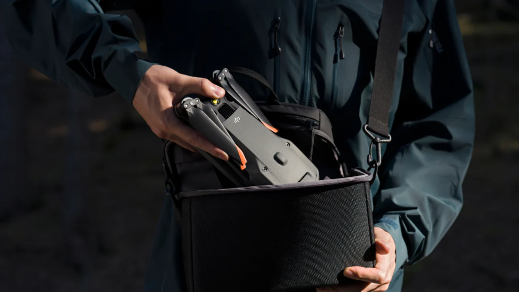
The M30 series, which has a similar body to the M300 RTK but in a smaller frame, is next up in the size range. While it’s not as portable and lightweight as the Mavic 3 Enterprise Series, it’s still small enough to fit in a backpack, offering a perfect balance of power and portability.
The M300 RTK is a much more substantial aircraft. It can still be deployed in less than two minutes, but it does not have the highly transportable nature of the other two.
That said, its size allows it to carry a significant amount of weight – with a maximum take-off weight of 9 kg – and it can integrate up to three payloads at a time.
| Mavic 3 Enterprise Series | M30 Series | M300 RTK | |
| Dimensions (L x W x H) |
Folded (without propellers): 221 x 96.3 x 90.3 mm; Unfolded (without propellers): 347.5 x 283 x 107.7 mm |
Folded: 365 x 215 x 195 mm; Unfolded (propellers excluded): 470 x 585 x 215 mm |
Folded: 430 x 420 x 430 mm; Unfolded (propellers excluded): 810 x 670 x 430 mm |
| Weight | DJI Mavic 3E: 915g DJI Mavic 3T: 920g (without propellers and accessories) |
3.7 kg (including two batteries) | Approx. 6.3 kg (with two TB60 batteries, and single downward gimbal) |
| Max Take-off Weight | DJI Mavic 3E: 915g DJI Mavic 3T: 920g (without propellers and accessories) |
4kg | 9kg |
Cameras/Payloads
Payloads and cameras will be discussed in detail later in this article, but the Mavic 3 Enterprise series, M30 series, and M300 RTK have different configurations and payload capabilities.
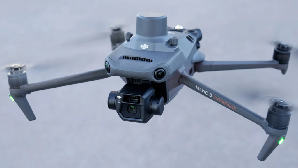
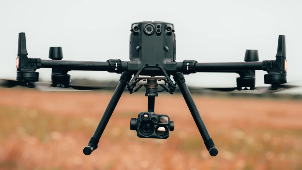
The Mavic 3 Enterprise Series features a fixed, multi-sensor camera. Optimized for surveying, the Mavic 3E has a wide (Hasselblad) and telephoto camera, while the Mavic 3T has a thermal camera, as well as a wide (non-Hasselblad) and telephoto camera. The Mavic 3E is at bottom left, while the Mavic 3T is at bottom right.
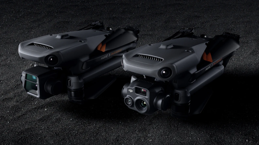
Accessories, such as the RTK module or speaker, can be attached to the top of the aircraft.
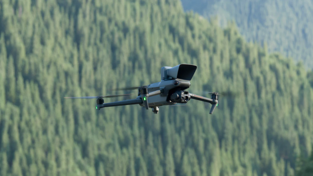
The same goes for the M30 series, which features a fixed, multi-sensor camera. The M30 has a wide-angle, zoom, and laser rangefinder, while the M30T – pictured below – matches the M30, but adds a thermal sensor.
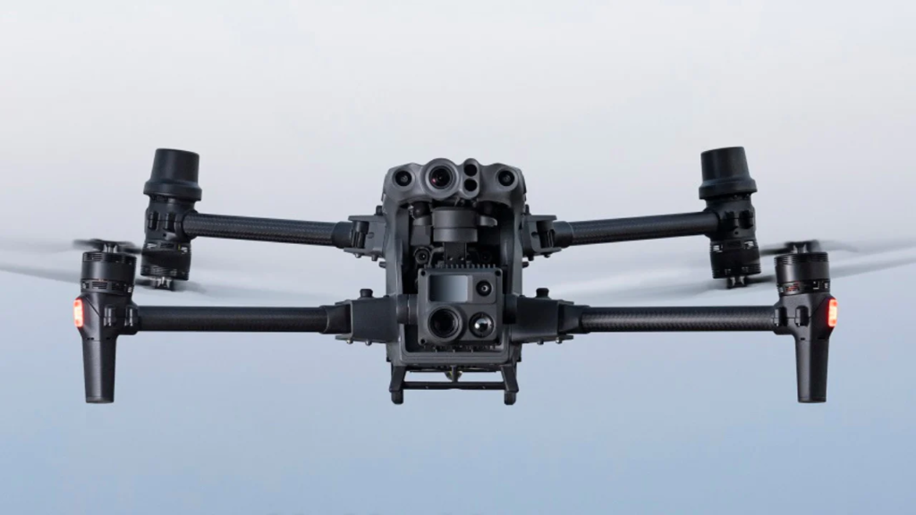
The M30 Series can also carry a third-party payload through the top door, such as the LP12 speaker and spotlight.
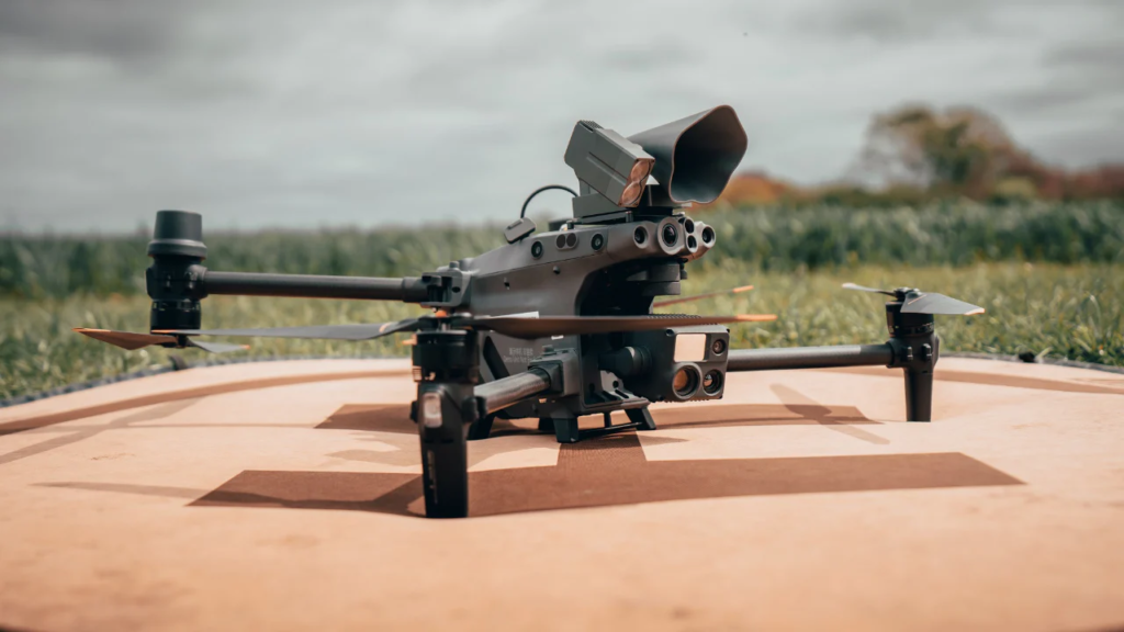
The M300 RTK, on the other hand, does not have a fixed payload: Rather, it can be integrated with a wide range of cameras and sensors – including LiDAR, photogrammetry, zoom, wide and thermal – and other accessories, such as spotlights, speakers, gas detection modules, night vision and agricultural sensors.
As mentioned, the M300 RTK can carry up to three payloads simultaneously, using the following configurations: Single downward gimbal; dual downward gimbal; single upward gimbal; up and down gimbal; triple gimbal.
This makes the M300 RTK DJI’s most versatile aircraft and ideally suited to scale as the business case evolves, which could be a major draw for some operators.
Mavic 3 Enterprise vs M30 Series vs M300 RTK: Cameras
As mentioned, the camera sets for the Mavic 3 Enterprise, M30 Series, and M300 RTK are different.
To examine the cameras in more detail and make them relevant to each operator, we will explore the payloads by application, highlighting each drone/sensor relevant to a specific use case.
These use cases include RGB photogrammetry, thermal missions, and visual data collection for operations such as public safety and inspections.
The best DJI drone for RGB survey photogrammetry
Drone surveys have become one of the main UAS applications.
When it comes to DJI's survey-grade RGB photogrammetry solutions, there are three main options: the Mavic 3 Enterprise, M300 RTK, and Zenmuse P1, and the M300 RTK and Zenmuse L1.
The DJI Phantom 4 RTK is also an option, but it has been replaced as DJI's primary compact survey solution by the Mavic 3 Enterprise, which beats it in flight time, sensor size, portability, and price.
For this reason, we have not included the P4 RTK in this comparison. However, read our blog Mavic 3 Enterprise vs P4 RTK for an in-depth comparison of these two compact mapping drones.
The table below provides an overview of the Mavic 3E, M300 RTK and P1, and M300 RTK and L1 for next-level RGB photogrammetry.
| Mavic 3 Enterprise with RTK Module (Wide Camera) | M300 RTK + Zenmuse P1 | M300 RTK + Zenmuse L1 | |
| Surveying Grade | Yes | Yes | Yes |
| RTK/PPK Support | Yes | Yes | Yes |
| GSD (cm) | H(m)/36.5 | 24mm: H(m)/55 35mm: H(m)/80 50mm: H(m)/120 |
H(m)/36.5 |
| Sensor Size | 4/3″: 5280 × 3956 (4:3) |
Full frame (35.9×24mm): 8192 × 5460 (3:2) |
1″; 5472 × 3648 (3:2) |
| Still Resolution | 20MP | 45MP | 20MP |
| Pixel Size | 3.3μm | 4.4μm | 2.4μm |
| Lens Option | 12mm/24mm Equivalent: FOV 84.0° |
P1 has interchangeable lenses: DL 24mm; FOV 84.0°; DL 35mm; FOV 63.5°; DL 50mm; FOV 46.8° |
8.8mm/24mm Equivalent: FOV 84.0° |
| Mechanical Shutter | Yes (1/2000-8s) |
Yes (1/2000-1s) |
Yes (1/2000-8s) |
| Minimum Photo Interval | 0.7s | 0.7s | 2.5s |
| Flight Time | Up to 42 mins (With RTK Module) | Up to 44 minutes | Up to 42 minutes |
| Memory Requirements | microSD UHS-I Speed Grade 3 ratings or above Max Capacity: 512GB |
SD UHS-I rating or above Max Capacity: 512GB |
microSD UHS-I Speed Grade 3 rating or above Max Capacity: 256GB |
| Smart Oblique Support | (Support Planned) | Yes | No |
| Real-time Terrain Follow | (Support Planned) | No | No |
All three solutions are survey-grade photogrammetry solutions that can achieve centimeter accuracy at 1:500 scale without installing on-site ground controls.
As a result, these products can effectively increase the efficiency of mapping and surveying work compared with other non-surveying optimized drones that do not have RTK/PPK and DJI TimeSync support.
It's worth noting that the M300 RTK has a built-in RTK module, while Mavic 3 Enterprise operators will need to purchase the RTK module separately to achieve centimeter-level accuracy.
Comparing the capabilities of these three photogrammetry solutions, it can be said that the P1 surpasses the M3E, which surpasses the L1.
This conclusion is mainly due to the resolution of the camera, the size of the sensor and pixels; a high resolution image can correspond to a high resolution map or a highly detailed model.
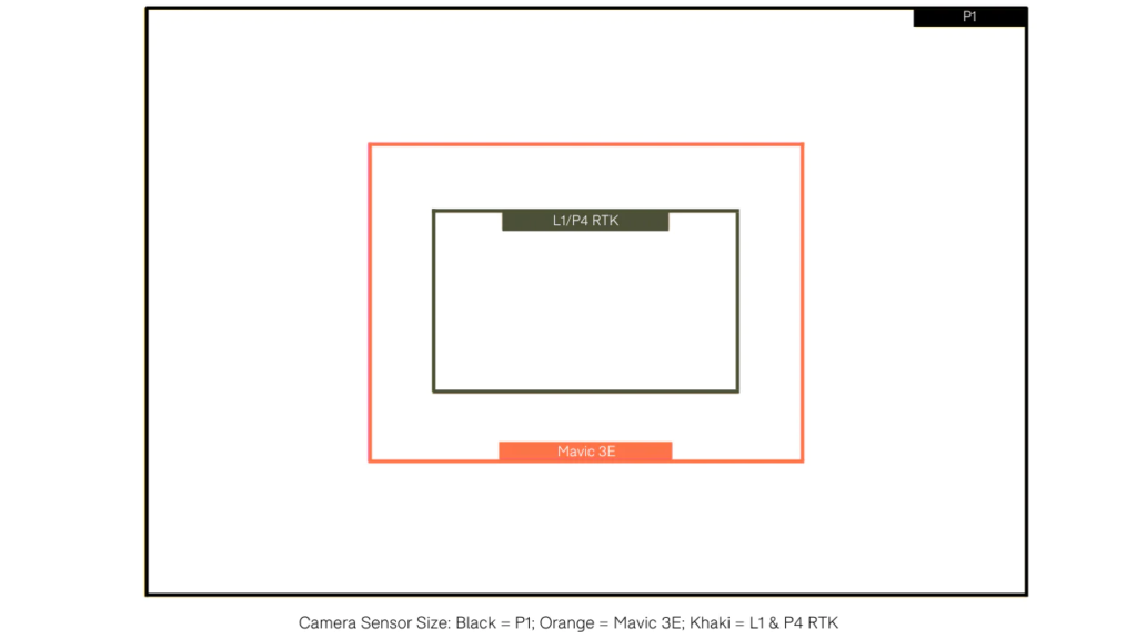
Larger pixels can ensure better dynamic range and image quality in low-light conditions, allowing for a wider operating window on site.
Additionally, the P1 offers multiple lens options that the user can select based on the flight scenario, while the L1 and Mavic 3 Enterprise have a fixed focal length with a fixed field of view.
The P1 can also fly higher to achieve the same GSD, increasing survey efficiency.
However, there are some factors to consider.
First, the L1 is not primarily a photogrammetry sensor: It is rather a LiDAR payload, with photogrammetry capabilities thrown in for good measure. In fact, the M300 RTK is the only drone capable of acquiring LiDAR data.
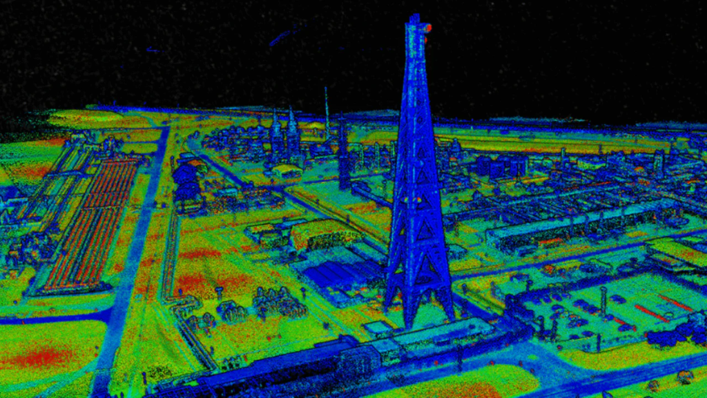
So for operators who want LiDAR datasets with the addition of photogrammetry, the L1 – as a dual mapping payload – is a great solution. Of course, operators can purchase the L1 and P1 for optimal LiDAR and photogrammetry data acquisition.
Second, the DJI Mavic 3 Enterprise features a telephoto camera in addition to the survey-optimized wide camera. While not strictly useful for drone mapping, the telephoto sensor allows operators to capture data with up to 56x hybrid zoom.
On the Mavic 3 Enterprise series front, the Mavic 3 Thermal can be used for mapping when using the RTK module, although it won’t be as accurate as surveying with the Mavic 3E. However, the Mavic 3T can be used to collect thermal mapping data, for example.
The following table provides an overview of each DJI RGB mapping solution for surveying and their ideal user profile.
| Matrix M300 RTK + Zenmuse P1 | Mavic 3 Enterprise | Matrix M300 RTK + Zenmuse L1 |
| For customers who want a next-generation photogrammetry camera for effective reality capture and surveying projects that require superior accuracy. | For customers who want a compact, fast-to-use reality capture solution for everyday work with survey-grade accuracy, the Mavic 3T is ideal for those looking to perform thermal mapping. | For customers who want an airborne LiDAR solution but need to execute visible photogrammetric mapping projects that require survey-grade accuracy. |
Mavic 3 Enterprise Series vs M30 Series vs M300 RTK: Public Safety and Inspections
The Mavic 3 Enterprise series, M30 series, and M300 RTK are all reliable solutions for public safety and inspections.
In this section, we will examine the ability of their cameras to acquire visual and thermal data (Mavic 3T, M30T and M300 RTK with H20T).
Visual data collection
| Mavic 3E | Mavic 3T |
M30 Series (M30 & M30T) |
M300 RTK + H20 Series (H20 + H20T) |
|
| Wide Camera |
Sensor Size/Pixels 4/3 CMOS; 20 MP Lens FOV: 84° Format Equivalent: 24 mm Video Resolution 4K@30fps |
Sensor Size/Pixels 1/2-inch CMOS; 48 MP Lens FOV: 84° Format Equivalent: 24 mm Video Resolution 4K@30fps |
Sensor Size/Pixels 1/2″ CMOS; 12MP Lens DFOV: 84° Focal length: 4.5 mm (equivalent: 24 mm) Video Resolution 4K/30fps |
Sensor Size/Pixels 1/2.3″ CMOS; 12 MP Lens DFOV: 82.9° Focal length: 4.5 mm (equivalent: 24 mm) Video Resolution 1080p@30fps |
| Tele/Zoom Camera |
Sensor 1/2-inch CMOS; 12 MP Lens FOV: 15° Format Equivalent: 162 mm Video Resolution 4K@30fps |
Sensor 1/2-inch CMOS; 12 MP Lens FOV: 15° Format Equivalent: 162 mm Video Resolution 4K@30fps |
Sensor 1/2″ CMOS; 48MP Lens Focal length: 21-75 mm (equivalent: 113-405 mm) Video Resolution 4K/30fps | Sensor 1/1.7″ CMOS; 20 MP Lens DFOV: 66.6°-4° Focal length: 6.83-119.94 mm (equivalent: 31.7-556.2 mm) Video Resolution 4K/30fps |
| Visual Zoom Capabilities | Up to 56x hybrid | Up to 56x hybrid | 5x-16x Optical Zoom 200x Max. Hybrid Zoom |
23× Hybrid Optical Zoom, 200× Max Zoom |
| Laser Rangefinder | Not supported | Not supported |
Wave Length 905 nm Measurement Range 3-1,200 m (0.5×12 m vertical surface with 20% reflectivity) Measurement Accuracy ± (0.2 m + D×0.15%) D is the distance to a vertical surface |
Wave Length 905 nm Measurement Range 3-1200 m (to a vertical surface with ≥12m diameter and 20% reflection rate) Measurement Accuracy ± (0.2 m + D×0.15%) D is the distance to a vertical surface |
| High resolution Grid Photo |
Not supported | Not supported | Supported | Supported |
Thermal data collection
In addition to visual data collection, the Mavic 3T, M30T, M300 RTK, and H20T are equipped with thermal sensors, ideal for search and rescue, firefighting, and inspection missions.
The Mavic 2 Enterprise Advanced is another compact and lightweight thermal solution, but it’s been replaced by the Mavic 3T, which has a longer flight time and improved vision, among other upgrades. For that reason, we won’t include the M2EA in the comparison below, but you can find out how it stacks up against the Mavic 3 Thermal in our in-depth blog.
The table below shows some of the key specifications of the thermal sensors on the Mavic 3T, M30T, and H20T.
| Mavic 3T | M30T | H20T | |
| Resolution | 640 x 512 | Infrared Image Super-resolution Mode: 1280 x 1024; Normal Mode: 640 x 512 |
640 x 512 |
| Frame Rate | 30 Hz | 30 Hz | 30 Hz |
| Lens | DFOV: 61°; Format Equivalent: 40mm |
DFOV: 61°; Focal length: 9.1 mm (equivalent: 40 mm) |
DFOV: 40.6°; Focal length: 13.5 mm (equivalent: 58 mm) |
| Photo Format | R-JPEG (16-bit) | R-JPEG (16 bit) | R-JPEG (16 bit) |
| Scene Range | -20°C to 150°C (High Gain); 0°C to 500°C (Low Gain) |
-20°C to 150°C (High Gain); 0°C to 500°C (Low Gain) |
-40°C to 150°C (High Gain); -40°C to 550°C (Low Gain) |
| Thermal Zoom | Up to 28x digital zoom | Up to 20x digital zoom | Up to 8x digital zoom |
| Temperature Alert | Supported | Supported | Supported |
| Isotherms | Supported | Supported | Supported |
| Temperature Measurement | Spot Meter and Area Measurement |
Spot Meter and Area Measurement |
Spot Meter and Area Measurement |
| Night Scene For Zoom Camera | Not supported | Supported | Supported |
The Mavic 3 Enterprise Series, M30 Series, and H20 Series are all multi-sensor payloads. All models come with a variety of features, including: Security encryption, Panorama mode, real-time mission planning, and quick switching between different cameras.
However, there are some key differences.
The Mavic 3 Enterprise Series does not have a laser rangefinder sensor. As such, it does not support range measurement and coordinate calculation functions with DJI Pilot 2 and DJI FlightHub 2. Incidentally, the Mavic 3 Enterprise Series, M30 Series, and M300 RTK are compatible with FlightHub 2, DJI's all-in-one cloud-based drone operations management platform.
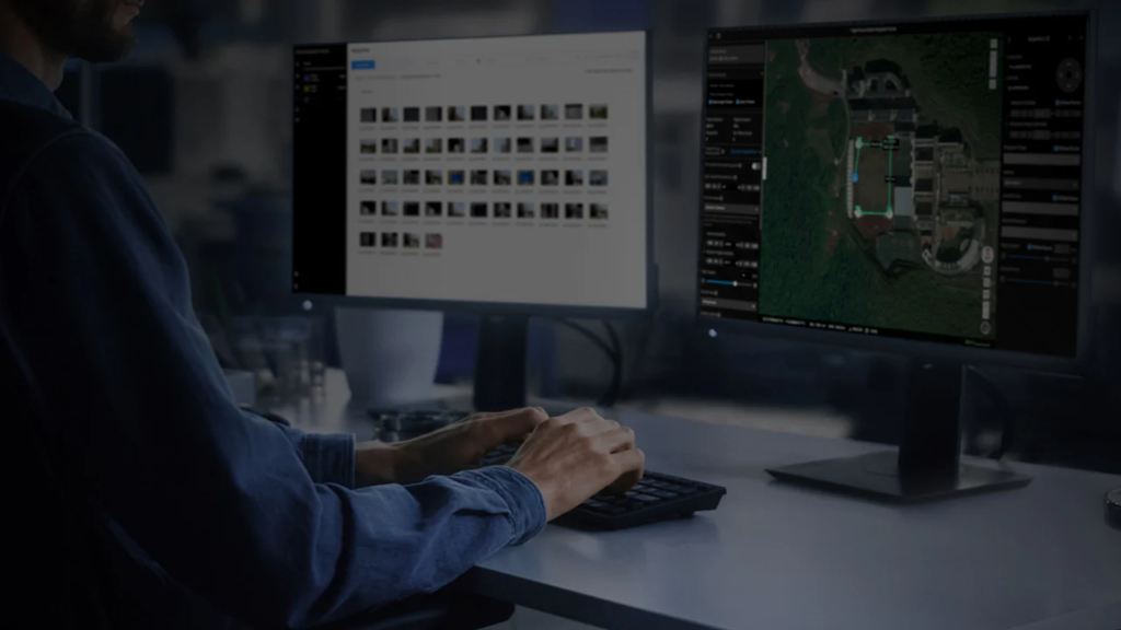
The laser rangefinder is also used for Smart Track, a high-resolution grid, and the camera’s visual zoom focus, which the Mavic 3 Enterprise Series lacks. However, the Mavic 3 Enterprise Series can fire “pins,” but only at the drone’s location.
Comparing the Mavic 3 Enterprise series, M30 series, and H20 series, the visual zoom of the H20 series slightly surpasses the M30T, which then surpasses the Mavic 3 Enterprise series.
The infrared modules are all very similar and have a resolution of 640 x 512. The M30T has a unique feature: it upscales the infrared photos four times the original, making the image sharper, but this may simply be a little nicer for operators in live view and does not affect the final data.
Recall that we said that the M300 RTK is an extremely versatile aircraft: Well, this means that, when it comes to collecting thermal data, the drone can integrate with thermal solutions other than the H20T, such as the FLIR Vue TZ20-R dual-zoom thermal payload and the IR10 infrared laser zoom payload for night vision.
It can also carry the DJI Zenmuse H20N Night Vision Sensor, complete with starlight visual sensors to provide exceptional performance in low-light conditions.
It’s fair to say that this results in low-resolution photos – with solutions like the M30T and H20T surpassing it for detailed visual inspections – and it’s not even recommended for thermal inspections.
But this fusion sensor was explicitly designed to optimize the efficiency of night operations, while maintaining good daytime performance for public safety.
The following table highlights the suggested user profile for each solution.
| M300 + H20 Series | M30 Series | Mavic 3 Enterprise Series |
| For customers who want to use the ultra-high resolution visual zoom camera for inspection photos and thermal data with the H20T. | For customers in the public safety and inspection sectors who need a system that is quick to install and portable enough, with greater visual zoom capability and top-of-the-line business features that are not present in the entry-level system, resulting in better data collection and the ability to operate in more challenging conditions. | Entry level portable drone (with the Mavic 3T offering a quality thermal solution) with longer flight time and improved visual zoom compared to the previous M2EA series. The most convenient solution. |
Mavic 3 Enterprise vs. M30 Series vs. M300 RTK: radio controls
Currently the three drones use different controllers…
- RC Pro Enterprise: Mavic 3 Enterprise Series
- RC Plus: M30 Series
- Smart Controller Enterprise: M300 RTK
…although compatibility with the M300 RTK is planned for the RC Plus at a later date.
Of the three controllers, it’s fair to say that the RC Plus is the standout option, thanks to its larger, brighter screen, longer battery life—especially with the addition of the external battery—and wider operating temperature range. It’s also the only RC with an IP rating.
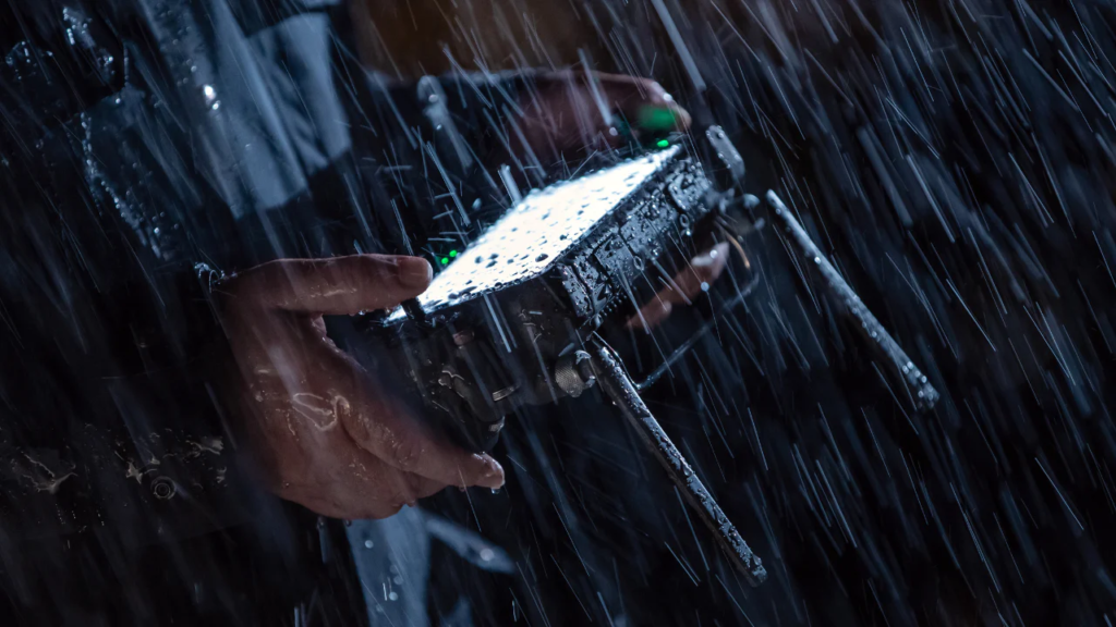
The following table highlights the key specifications of the three controllers.
| RC Pro Enterprise | RC Plus | Smart Controller Enterprise | |
| Screen Size | 5.5 inches | 7.02 inches | 5.5 inches |
| Brightness | 1,000 cd/m2 | 1,200 cd/m2 | 1,000 cd/m2 |
| Operating Time | 3 hours | Internal Battery: 3.18 hours; Internal + External Battery: 6 hours |
Internal Battery: 2.5 hours; Internal + External Battery: 4.5 hours |
| Hot Swappable Battery | No | Yes | No |
| Operating Temperature | -10°C to 40°C | -20°C to 50°C | -20°C to 40°C |
| IP Rating | No | IP54 | No |
| Video Transmission | 8km | 8km | 8km |
| 4G Dongle | Not currently | Yes. DJI Cellular Module | Yes. ZTE MF833V dongle |
| Drone Compatibility | Mavic 3 Enterprise Series | M30 Series; *M300 RTK compatibility expected |
M300 RTK |
Mavic 3 Enterprise vs M30 Series vs M300 RTK: Flight Performance
The Mavic 3 Enterprise, M30 series, and M300 RTK are reliable aircraft with impressive flight performance.
However, there are some key differences that set them apart and could make a big difference, depending on your needs.
Assessment of weather conditions
The first is the ability of drones to handle inclement weather.
The M30 series is DJI’s most weatherproof drone, boasting an impressive IP55 rating. While not fully waterproof, the aircraft is protected from the elements.
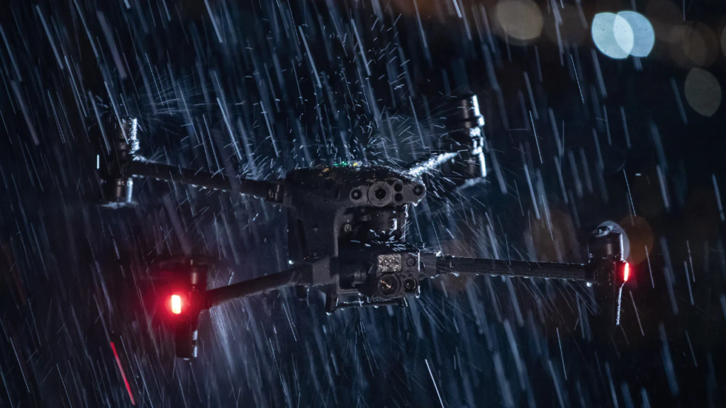
As an added benefit, the M30 Series RC Plus has an IP54 rating.
By comparison, the M300 RTK has an IP45 rating, making it slightly less water resistant than the M30 series. The accompanying Smart Controller Enterprise is not IP rated, although RC Plus compatibility is planned soon.
At the other end of the spectrum, the Mavic 3 Enterprise series doesn’t have an IP rating, meaning it can’t handle getting wet as well as the others.
The importance of this aspect depends on the specific requirements of each operator/organization.
| Mavic 3 Enterprise Series | M30 Series | M300 RTK | |
| IP Rating | No | IP55; RC Plus controller: IP54 |
IP45; Check each payload for specific IP Rating) |
| Operating Temperature | -10°C to 40°C | -20°C to 50°C | -20°C to 50°C |
| Max Wind Speed | 12 m/s (during take-off and landing) |
15 m/s; 12 m/s during taking off and landing |
15 m/s; 12 m/s during taking off and landing |
Flight time
The Mavic 3 Enterprise Series, M30 Series, and M300 RTK drones all boast impressive flight endurance.
Considering the small size of the drones, the Mavic 3 Enterprise Series can fly for up to 45 minutes, which is pretty impressive for such a compact aircraft. To put that into perspective, DJI’s older lightweight solutions weren’t capable of such a long flight time, with the Mavic 2 Enterprise Advanced and Phantom 4 RTK only reaching around 30 minutes of flight time.
With the perfect combination of power and portability, the M30 Series offers up to 41 minutes of flight time – a remarkable amount of battery life for a drone that has an impressive IP rating and top-notch flight specifications.
The M300 RTK’s flight time varies depending on the payload it is used with, but it is capable of reaching over 40 minutes. Even when fully loaded to its maximum take-off weight – a rather hefty 9 kg with up to three payloads – it can fly for 31 minutes, which is a very good return considering the multiple sensors on board.
The following table provides a summary of the flight times for each drone. Note that in the case of the M300 RTK, the table is not a definitive list, as the drone can be operated with numerous payloads.
| Mavic 3 Enterprise Series | M30 Series | M300 RTK |
| Maximum flight time: 45 minutes With RTK module: 42 minutes |
Maximum flight time: 41 minutes | No payload: 55 minutes Z30: 46 minutes XT2: 45 minutes H20: 45 minutes P1: up to 44 minutes H20T: 43 minutes L1: up to 40 minutes Z30 + XT2: 39 minutes H20 + XT2: 39 minutes Maximum load: 31 minutes |
Other flight features
Among other flight performance features, the M300 RTK and M30 Series have additional aircraft component redundancy, an integrated FPV camera (additional point of view when using dual operators), and a dedicated battery station for faster charging.
Mavic 3 Enterprise Series vs M30 Series vs M300 RTK
One of the biggest differences between the Mavic 3 Enterprise Series, M30 Series, and M300 RTK is price, which could play a major role in choosing the right platform.
The Mavic 3 Enterprise series represents great value: It’s affordable and packs a lot of power into a small frame.
The Mavic 3E launched at a price of just over €3,500, while the Mavic 3T was introduced at a price of just over €5,500 (both prices do not include accessories, such as the RTK module). From a budget perspective, both drones are more affordable than the lightweight, compact aircraft they look set to replace: the P4 RTK and the Mavic 2 Enterprise Advanced.
There are some sacrifices and performance limitations compared to the M30/M300 RTK series, but they represent great value, especially as an entry-level aircraft and as a rapid deployment solution.
The M30 series is the mid-level option, with the M30T being more expensive than the Mavic 3 Enterprise series, but the additional investment comes with additional benefits, such as powerful camera specs, high durability, an impressive IP rating, and a high-quality controller. In many ways, the M30 series is an M300 RTK in a smaller, more portable package, but without the versatility.
The M300 RTK is the most expensive solution. Adding payloads to the platform can quickly drive the price up: But remember that the price-performance ratio is very high, thanks not only to a robust, powerful and highly versatile aircraft, but also to the high-quality and industry-leading cameras and sensors that accompany it.
Mavic 3 Enterprise Series vs M30 Series vs M300 RTK: Recap
The Mavic 3 Enterprise Series, M30 Series, and M300 RTK are all quality commercial aircraft. But because of their differences, they each have different user profiles. Which one is right for you depends on factors like use case, budget, and experience.
At the far end of the spectrum is the Mavic 3 Enterprise Series. Lightweight, compact, and packing a multi-sensor payload, the Mavic 3E and Mavic 3T are extremely affordable platforms that are well-suited as entry-level aircraft and perfect for quick and easy deployment. But there are some trade-offs, including a lack of IP rating, some performance limitations, and, in the case of the Mavic 3E, a camera that isn’t as capable as the M300’s P1 for precision surveying.
Then there’s the M30 series, which ticks all the right boxes. More expensive than the Mavic 3 Enterprise series, but more compact than the M300 RTK, the M30 series offers power, performance, and portability. While not a survey solution, it’s a great option for inspections and public safety, especially with its impressive IP55 rating, coupled with a weather-resistant controller, effective payload, and high endurance.
If there’s one concession to the M30 Series, it’s that it doesn’t have the versatility of the M300 RTK – mostly because it’s not suited for precision surveying – but compatibility with modules like speakers and spotlights ensures the M30 Series can be augmented to aid mission efficiency and success in a public safety or inspection scenario.
Then there’s the M300 RTK. DJI’s flagship enterprise aircraft is its most expensive, but its unmatched versatility and ability to carry up to three payloads, along with powerful performance features, make it a stellar choice.
Its versatility allows drone programs to conduct a variety of missions with a single platform; think of public safety, where the requirement can range from zoom and thermal cameras, to spotlights, speakers and payloads for crime scene surveys. Its payloads are at the forefront of the industry, with solutions like the P1 or L1 opening up new horizons in terms of efficiency, accessibility and quality of surveys conducted with drones.
It is particularly suitable for experienced operators, but that does not mean that novice pilots cannot choose the M300 RTK directly.


 https://www.instagram.com/3digital.tech/